Big Ten - Amsel
Projects
-
Critical Metals, Ontario
-
Porphyry Copper, Nevada
-
Diamonds
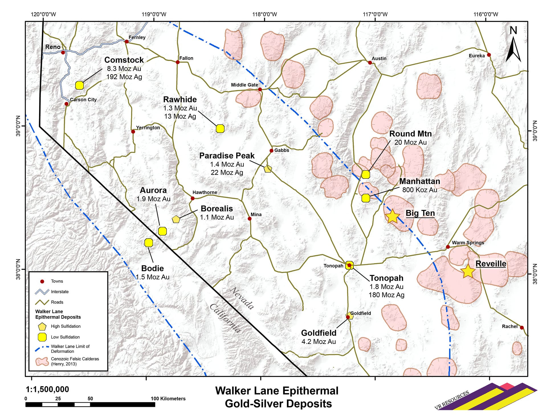
The Big Ten project is located along the northern margin of the of the Walker Lane belt in west-central Nevada. It occurs in an extensional, Tertiary-aged rhyolite volcanic centre and caldera analogous in age and setting to the Round Mountain gold mine located approximately 50 km to the northwest where cumulative and continuous mine production for nearly 120 years, starting in 1906, now exceeds 20 million ounces of gold (Kinross Gold Corporation). The past-producing Paradise Peak gold deposit operated by FMC Mining Corp. between 1986 and 1994 is located 110 km to the northwest of Big Ten.
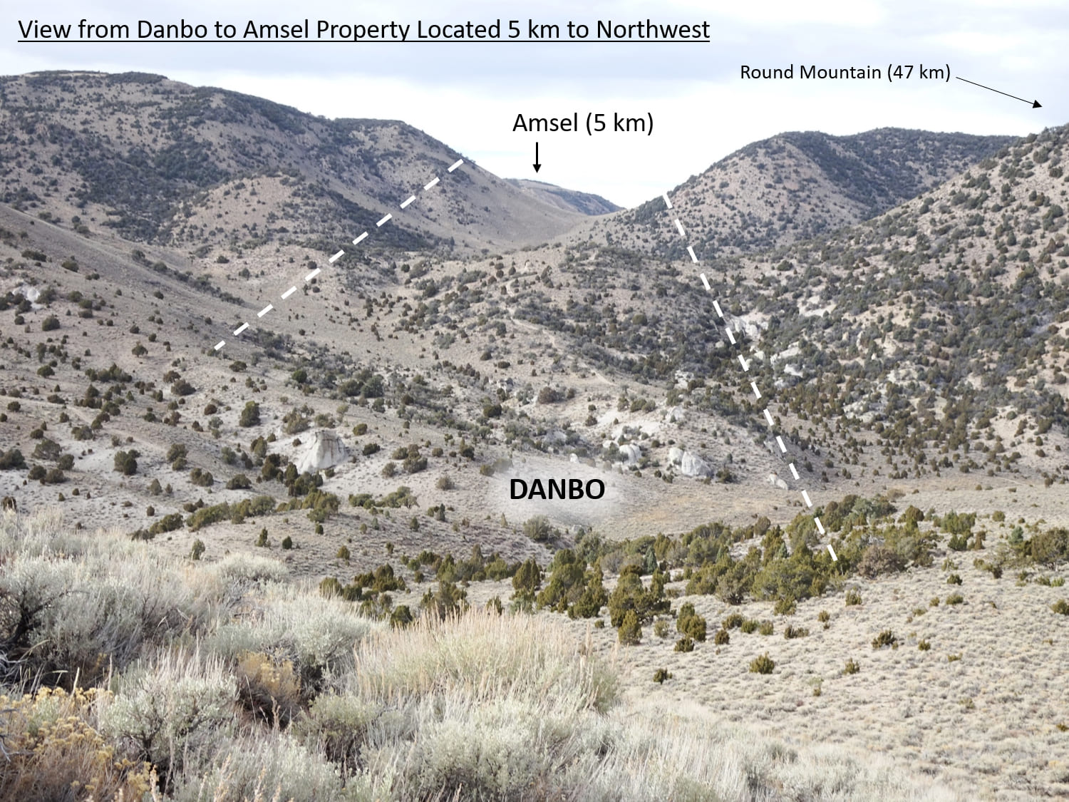
Based on reconnaissance surface exploration and airborne magnetic, radiometric and hyperspectral surveys completed over three years between 2016 and 2019, the Company has established a trend of showings of northwest-trending epithermal gold-silver veins along a 20 km structural corridor and mineral trend which transects the western part of Big Ten caldera, and is parallel to the eastern margin of the Walker Lane belt itself. The potential of the Big Ten mineral trend is underscored by analogies in age, structural setting, host rocks, and epithermal alteration and sulfide mineralogy to the Round Mountain caldera and gold deposit to the northwest, along trend. VR’s land position at its Amsel and Danbo properties affords the opportunity to explore a more complete swath of the epithermal gold-silver system at Big Ten, both laterally and vertically.
There are scattered historic workings in the region, active between the 1900’s and 1930’s, but modern exploration is limited to early-stage surface sampling and a reverse-circulation drilling program in the early 1980’s by Amselco at the Danbo and Amsel properties. Overall, the properties in the Big Ten project are remote and underexplored using modern epithermal gold exploration technologies, but there is road access for cost-effective exploration.
The Company now has five years of exploration under its belt along the 20 km long trend of gold-silver veins within the Big Ten caldera. Overall, VR is focused on the strong correlation between pyrite, adularia and gold-silver geochemistry in both rocks and soil at Amsel, and along the entire 20 km trend of mineral showings within the Big Ten caldera. High-grade veins at the Danbo property were the initial focus, but it is the Amsel property that has produced the most compelling and integrated target for a large-scale epithermal gold-silver system.
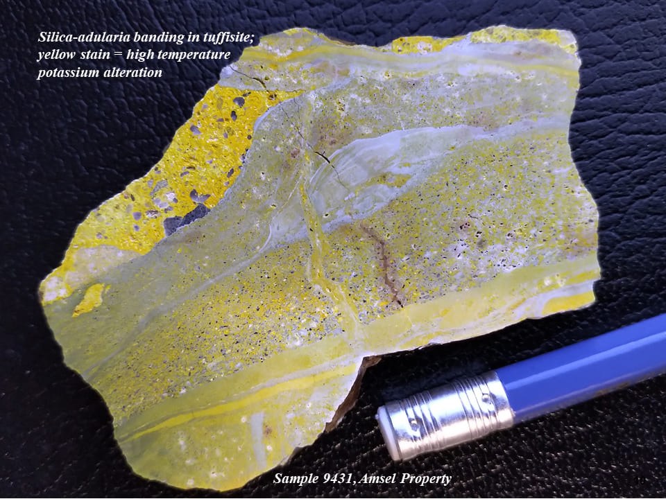
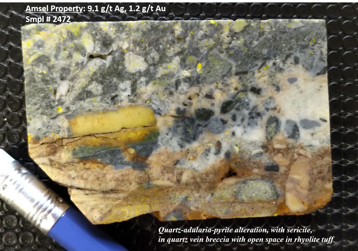
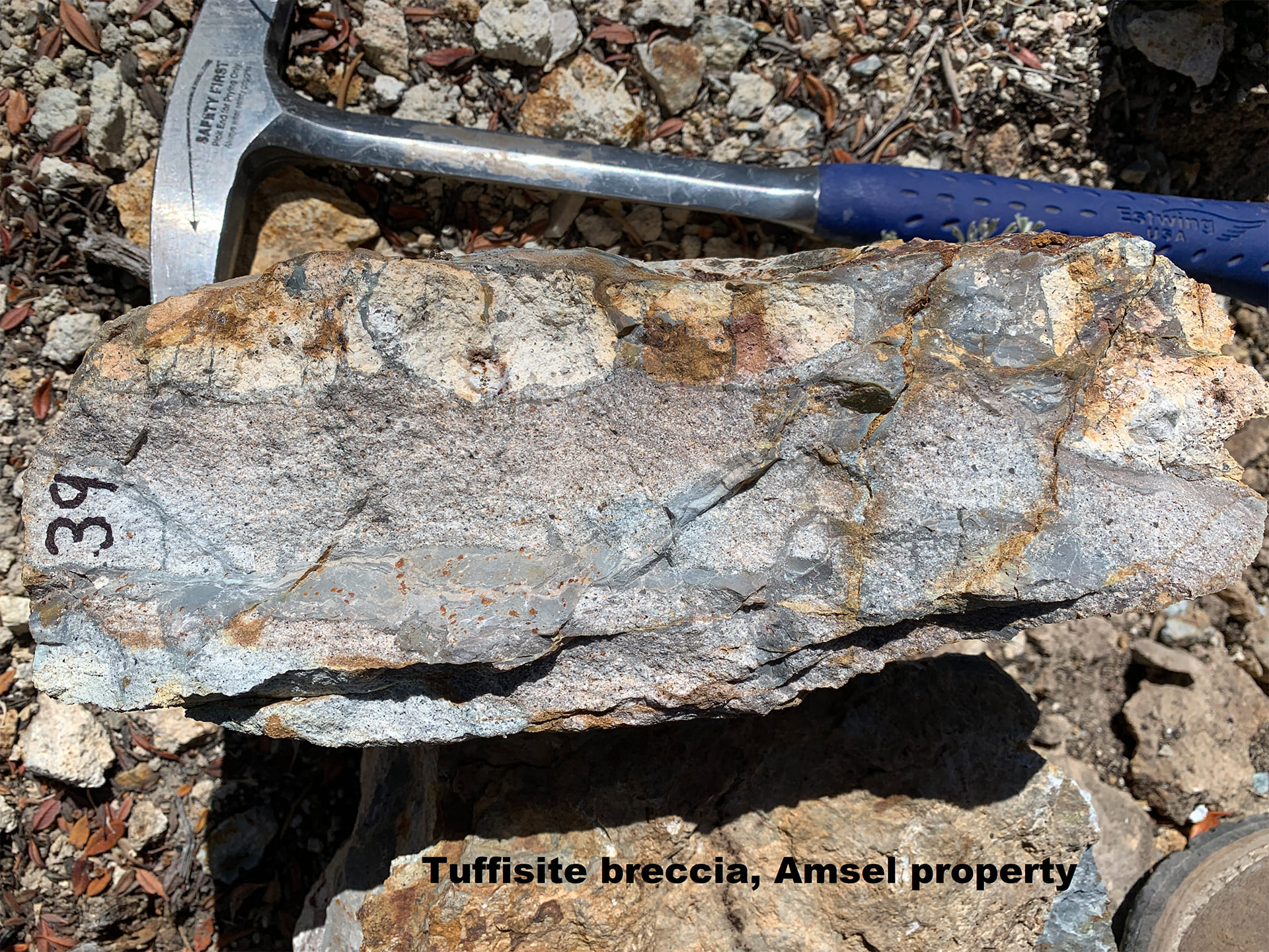
Overall, Amsel is a hilltop of silica-adularia altered volcanic tuff and tuffisite with gold and silver - bearing quartz vein stockworks and quartz vein breccia ultimately structurally controlled and basement influenced near the western margin of the caldera, and with the potential for a large tonnage, epithermal gold deposit comparable to Round Mountain located to the north.
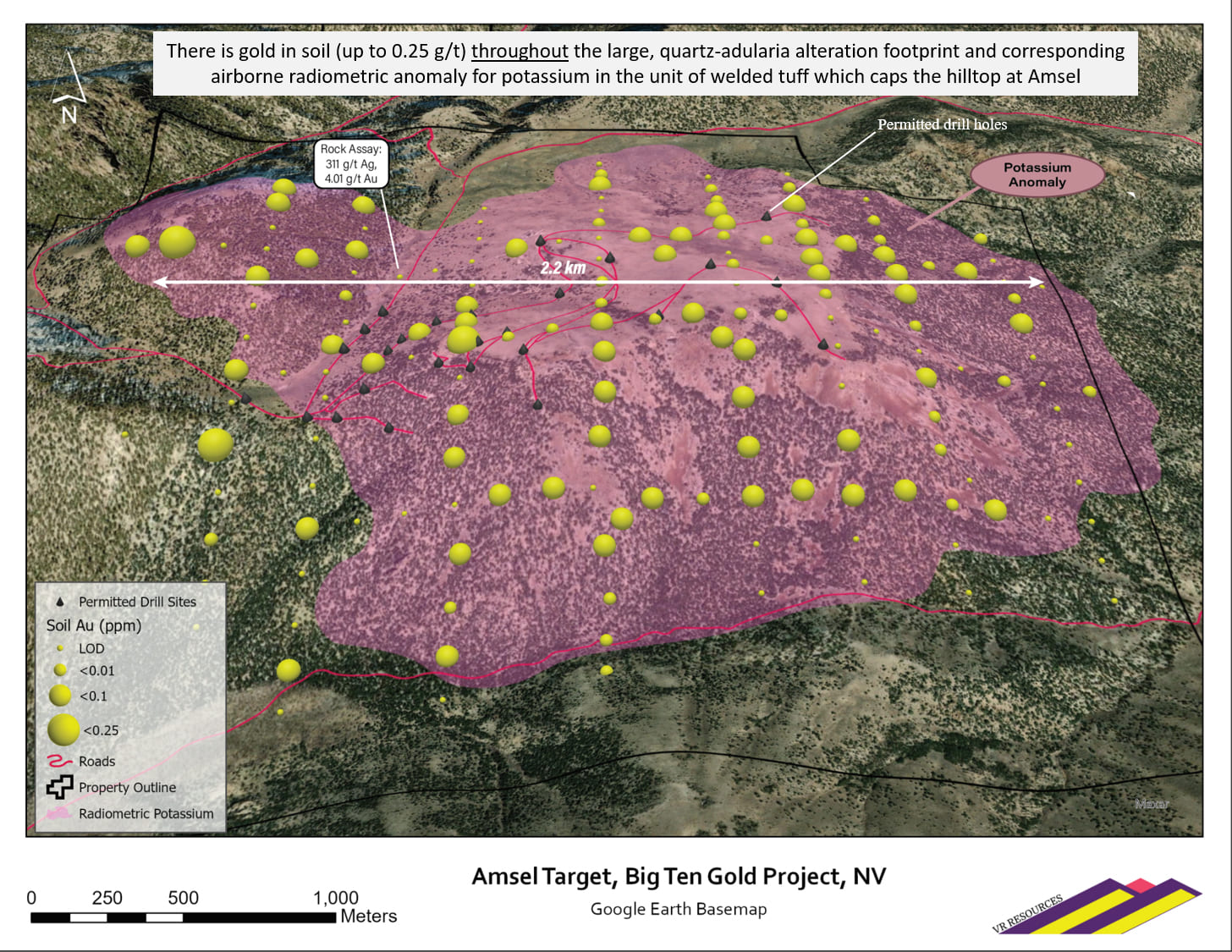
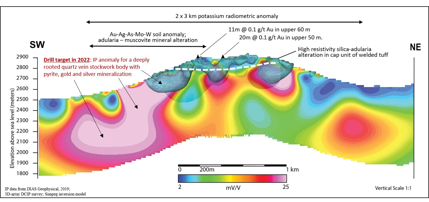
Despite easy road access to the property, historic exploration focused on the hilltop where topography is subdued and tree-cover sparse. However, the hilltop is covered by a stratigraphic cap unit of nearly impermeable welded tuff that impeded hydrothermal fluids. This cap unit itself has a widespread and pervasive quartz-adularia alteration with overprint of sericite and clay, and gold in soil up to 0.25 g/t. VR’s target is the core of the epithermal system on the southwest flank of the hill, below the strongly altered and but weakly mineralized stratigraphic cap blanketing the hill top. The target is defined by the integration of a broad array of new data collected by VR from geological and structural surface mapping, stratigraphy, grid-based rock and soil geochemistry, airborne radiometric and airborne and ground-based hyperspectral surveys for alteration mineral mapping, and ground-based, 3D-array DCIP geophysics. Importantly, this target is new; it has never been drilled historically.
The current objective is to complete Phase II of the reconnaissance drilling at Amsel, in follow-up to Phase I completed in 2022. The goal is the discovery of pyrite-bearing quartz veins, vein stockworks and tuffisite vein breccia in the central root and driver of a low-sulfidation epithermal system responsible for the large and intense alteration footprint exposed on surface.
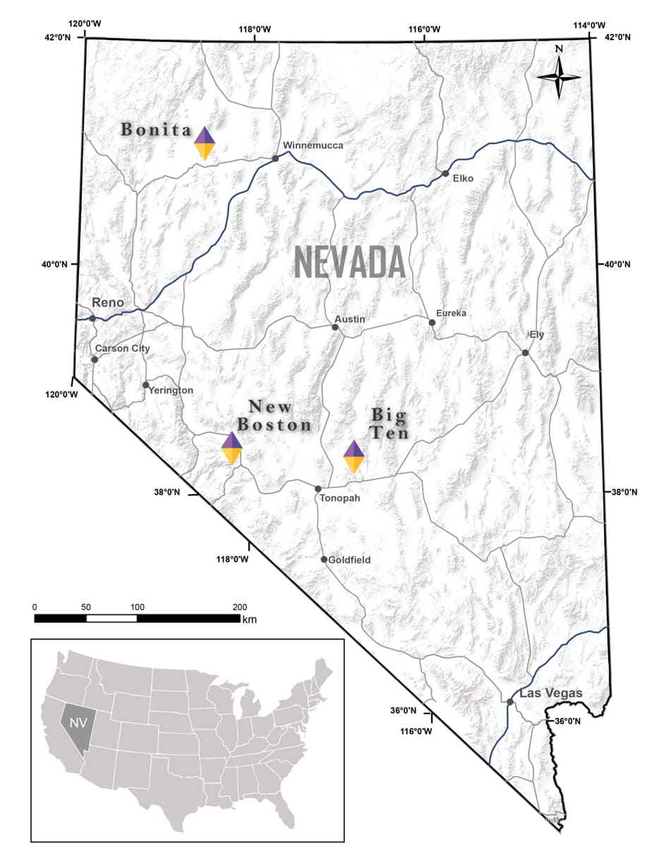
The Big Ten project is located in Nye County in west-central Nevada. It is in the southern part of the Monitor Range, approximately 50 kilometres northeast of Tonopah.
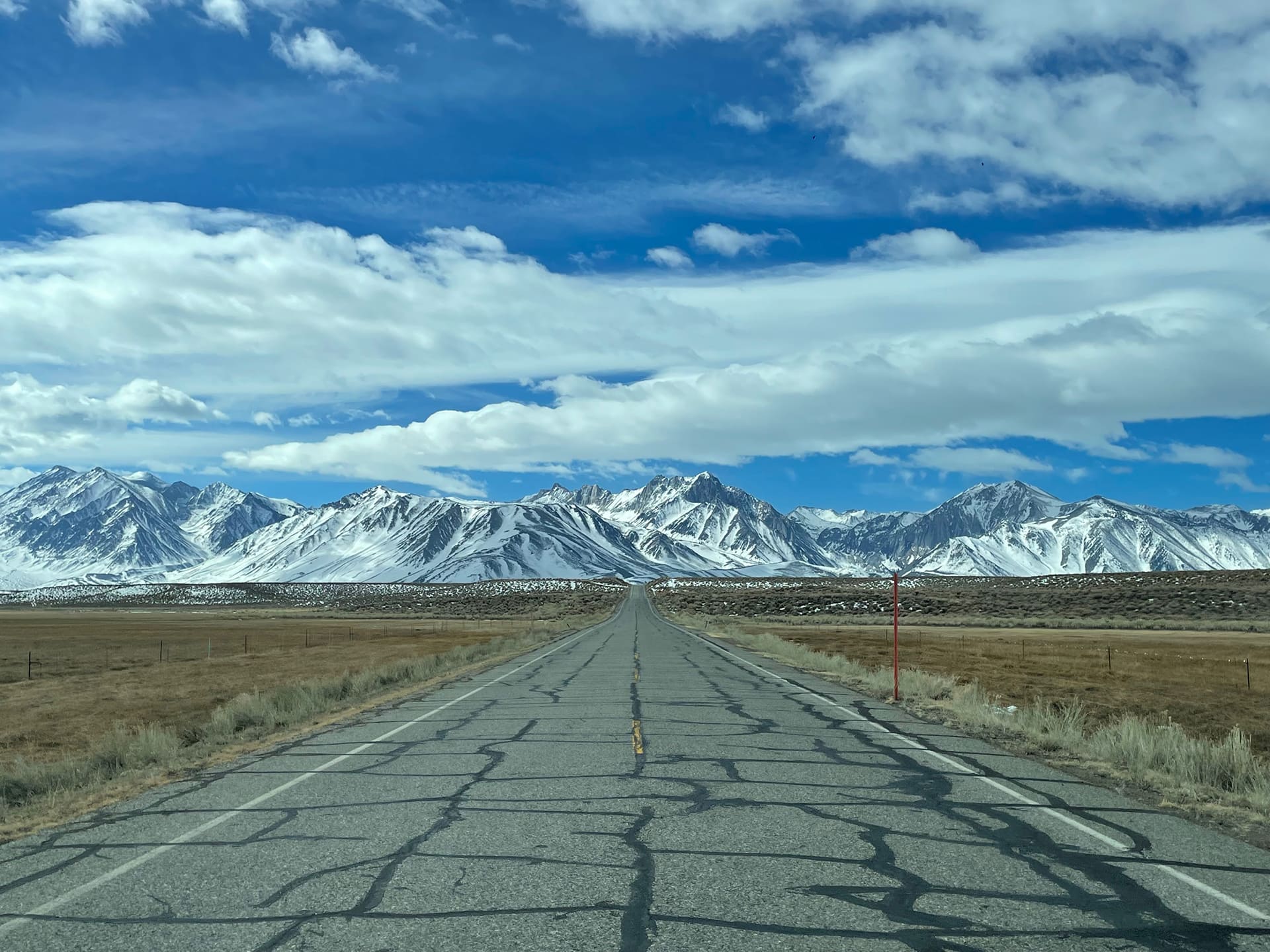
Cost effective exploration is afforded by road access to the property on Highway 82, with actively used historic ranch and mine roads throughout the property connecting it to the highway.
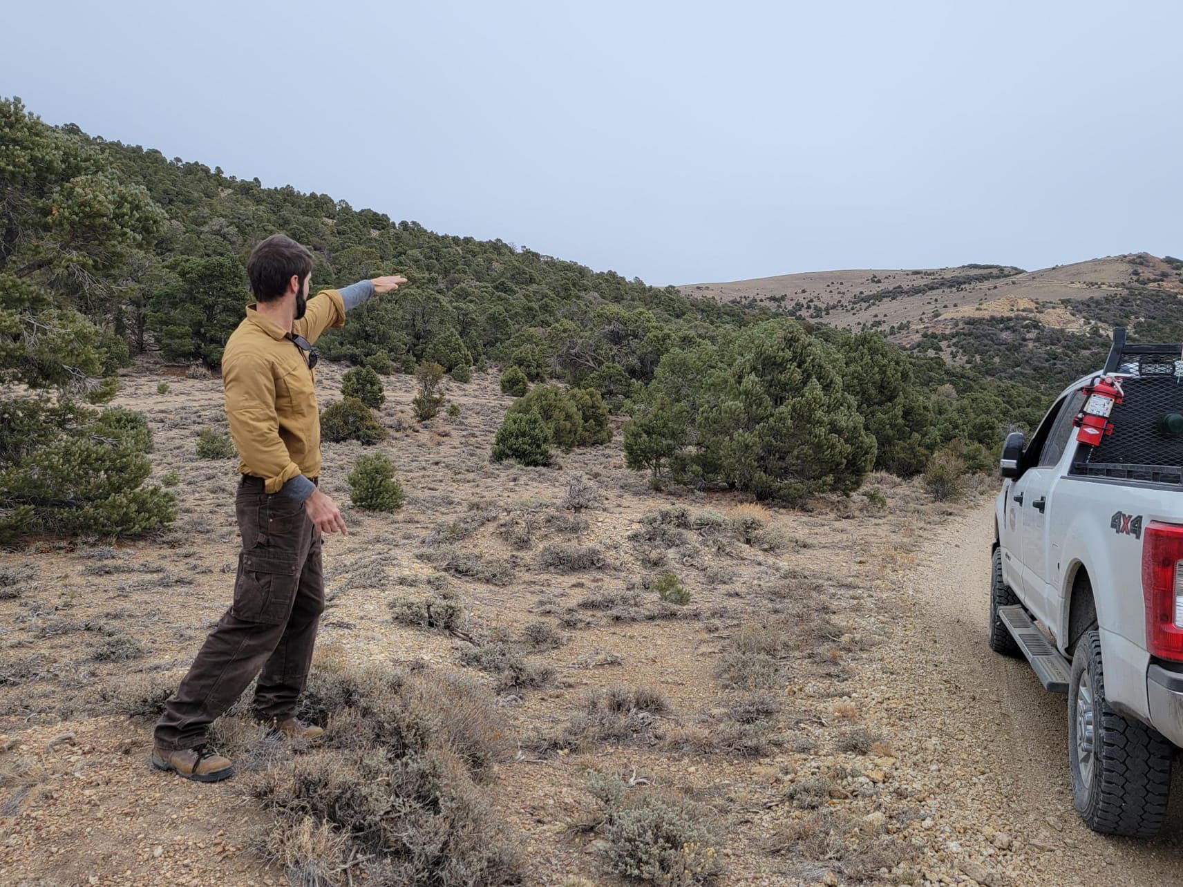
Topography is mountainous. The main workings at the Danbo property are at an elevation of 7,900 feet, with surrounding ridges and rounded peaks exceeding 8,800 feet. Sub-alpine bowls are grassy rangeland with scattered sage and stunted pine and juniper in some places.
Outcrop is extensive in the sub-alpine areas. Where there is cover, colluvium is interpreted to be thin and local in nature. Soil profiles are poorly developed; fine, light brown colluvium normally gives way to more rubbly-weathered outcrop material within a metre of depth, or less.
The Company once owned seven properties along the 20 km length of the Big Ten mineral trend, comprising 117 claims covering 2,417 acres in total. The holdings have been reduced to the two highest priority targets with the strongest mineral potential, namely Danbo and Amsel:
- Amsel: 12 claims in one contiguous block; large airborne radiometric anomaly (potassium) 2 x 3 km in size with a robust gold-silver-tungsten-moly’ soil anomaly occurring in the southwest quadrant, correlated with an integrated IP and resistivity anomaly covering 700 x 900 metres, and covered by the current claim group.
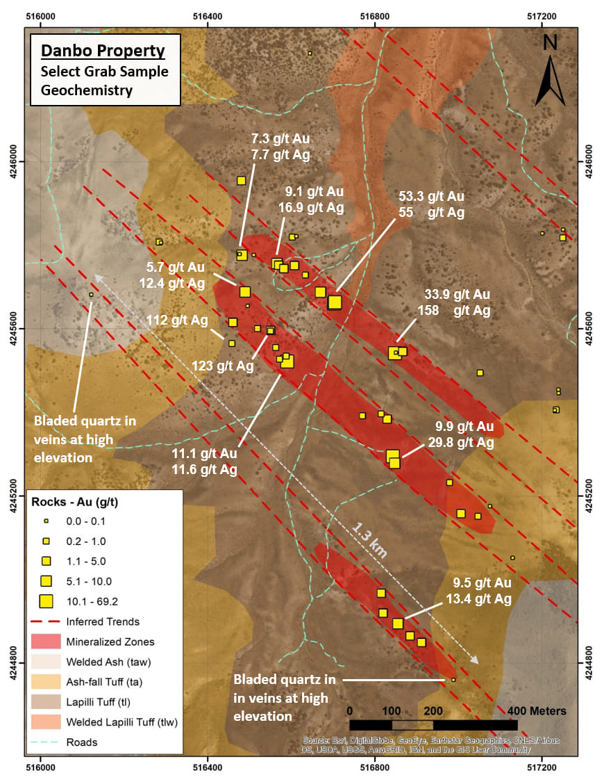
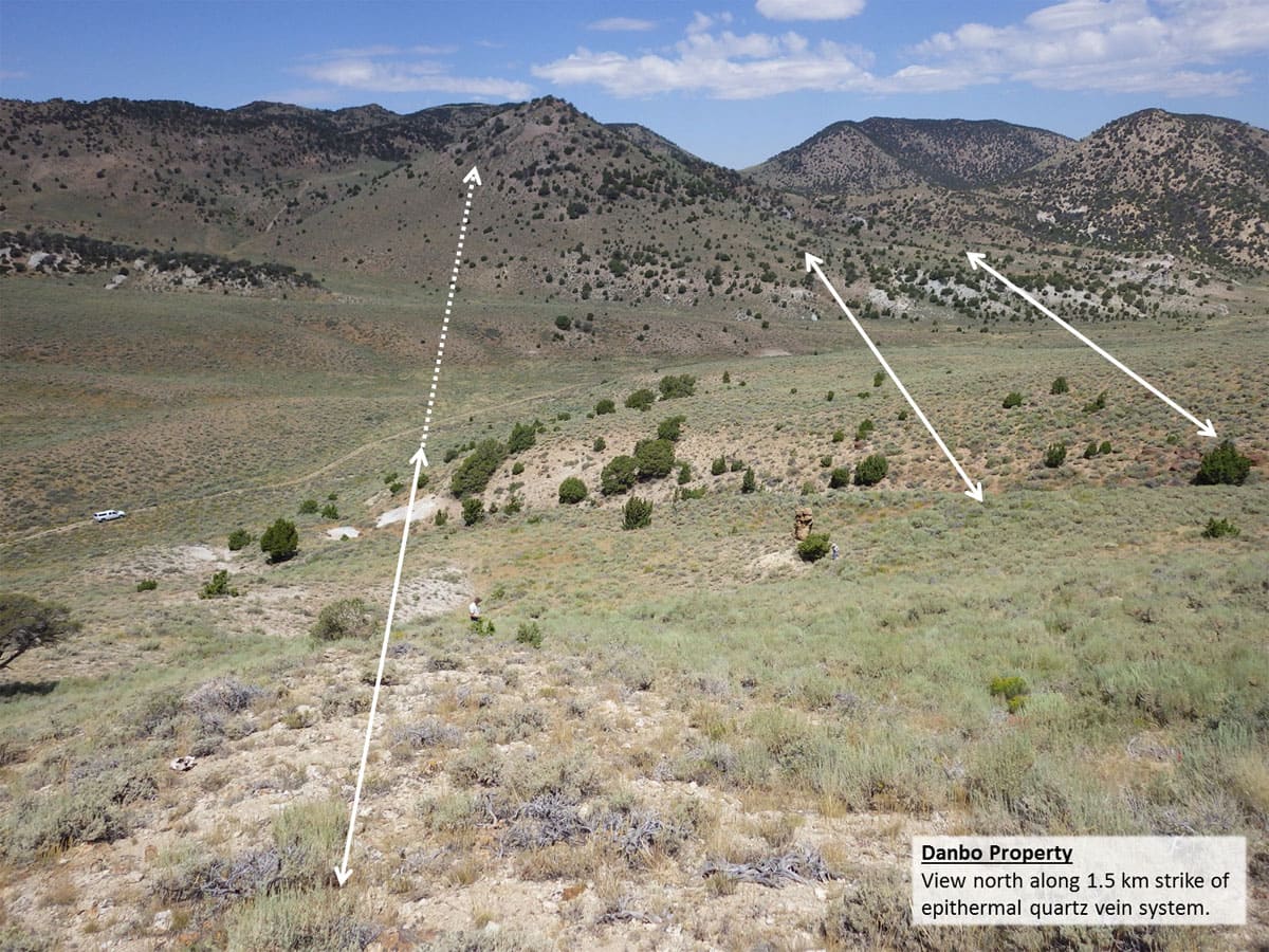
- Danbo: 21 claims, 434 acres; gold at surface in 3 quartz vein sets with 1.3 km strike, and located approximately 3 km to the southeast along trend from Amsel.
The properties are on federal land (BLM), within the Toiyabe National Forest managed by the federal National Forest Service. The properties are outside of the BLM’s broadly defined area of sage grouse protection.
The properties are owned 100% by VR, registered to the Company’s wholly-owned, Nevada-registered US subsidiary Renntiger Resources USA Ltd. There are no underlying annual lease payments on the property, nor are there any joint venture or carried interests on the property. There is a 3% net smelter returns royalty on the Danbo property, and a 2% net smelter returns royalty on the Amsel property.
VR has completed numerous reconnaissance surveys and detailed field programs on the various properties within the Big Ten project, starting in the fall of 2016. Work includes:
2016; Danbo Property
- Geological mapping of Tertiary volcanic stratigraphy, and structural mapping of the gold-bearing epithermal quartz vein system;
- Alteration mapping in the field, aided by systematic collection of 43 samples of vein outcrops for SWIR spectral analyses (TerraSpec mineral reflectance alteration mapping);
- Soil sampling: 96 samples on 50 metre stations on 6 lines covering 800 m strike length of the vein system;
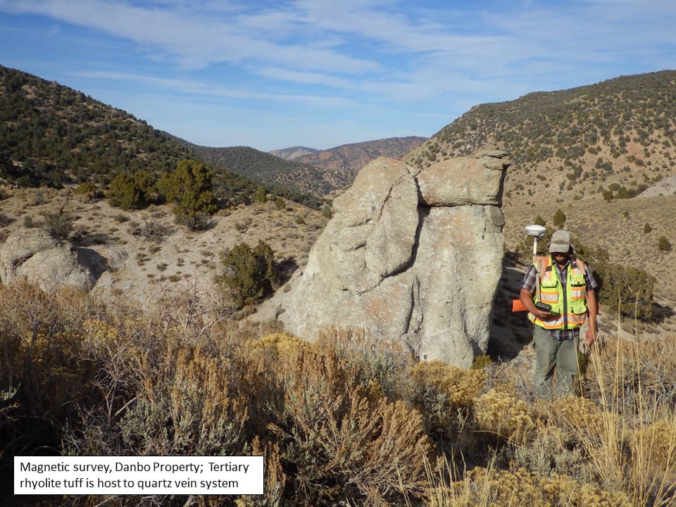
- Ground magnetic survey: 16 lines, 600 m long, on 100 spacing, for 9.6 line-kilometres covering an overall area of approximately 1.6 kilometer by 600 metres, covering the entire known vein system.
2017; Danbo Property
- Airborne Hyperspectral survey for mineral alteration mapping covering 3 x 1.5 km area: 3 metre pixel resolution; Level III processing and interpretation;
- Soil Sampling: 49 additional samples to extend and infill existing samples; and
- Rock sampling for geochemistry: 59 samples.
2018; Amsel Property
An airborne magnetic and radiometric survey, and an airborne hyperspectral survey used to map alteration minerals were completed in June 2018, covering the Amsel property and the northern part of the Big Ten mineral trend:
- Helicopter-borne, high resolution magnetic and radiometric survey covering 8 x 10 km block: 108 lines at 100 m spacing for 912 line-kms;
- Fixed-wing hyperspectral survey covering 10 x 12 km block centered over the airborne magnetic survey block; 15 flight lines, 1m pixel resolution, Level III processing and interpretation;
- Based on the results of the airborne surveys, VR completed a nine-day field program of reconnaissance – level and detailed geological mapping, prospecting and rock sampling along the Big Ten trend (54 samples).
A one-week follow-up program of geological mapping and prospecting was completed later in the fall of 2018, during which an additional 28 rock samples were collected.
2019; Amsel Property
VR completed a one-week surface program of grid-based geological mapping and grid-based sampling over the entire silicified hill top and radiometric anomaly at the Amsel property in August, and again in October, 2019. Work included:
-
Outcrop-scale, grid-based geological mapping and sampling of quartz
veins and fractures
- 57 samples for geochemistry;
- 7 samples for plain light and reflected light petrography;
- 2 samples for geochronology.
- Grid-based soil geochemistry for gold, silver and epithermal trace element indicators: 165 samples from 100 metre-spaced stations on 10 lines covering the 1.8 x 2.2 km are centered on the airborne potassium anomaly and coincident silicified hill top;
- Rock geochemistry and alteration mineral mapping by SWIR and LWIR mineral reflectance on individual rock samples from 135 stations on the soil grid, by TerraCore based in Reno, Nevada.
Geochemical data obtained from this work identify robust, integrated anomalies in gold and silver, trace element indicators arsenic and antimony, and high temperature elements molybdenum, tungsten and lead. Together with occurrences of the high temperature alteration minerals adularia and muscovite, there is a clear exploration vector for the center of the overall hydrothermal gold-silver mineralizing system at Amsel in the southwest quadrant of the 2 x 3 km airborne radiometric anomaly and corresponding surface alteration zone.
Because gold is associated with fine-grained sulfide in epithermal quartz veins and quartz vein breccia throughout the Big Ten mineral trend, the Company completed a 3D array, DCIP ground geophysical survey in November, 2019, to cover the entire airborne radiometric anomaly and related multi-element geochemical anomaly and quartz-adularia alteration cap at Amsel:
- 6 lines @ 3.2 km long and 200m line-spacing for 19 line-km in total in a grid area of 3.2 x 1.2 km;
- 100 m stations, with separate surveys run on pole-dipole & dipole-dipole configurations;
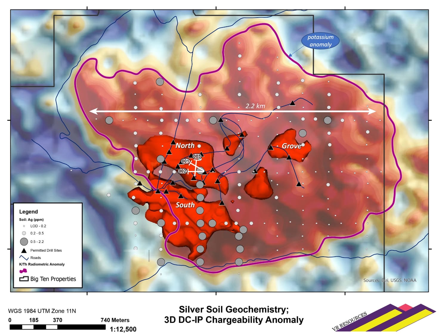
The IP survey images resistivity and chargeability features to a depth of 500 m below the hilltop at Amsel, within a 3D modeling space of 2.2 sq-kms. Changes in resistivity are related to secondary quartz and adularia alteration, and chargeability anomalies are targeted for pyrite-bearing gold-silver epithermal quartz veins and quartz vein breccia stockworks.
The results of the IP survey are clear. There is a large, near-surface high resistivity anomaly covering a 700 x 900 m area in the southwest quadrant of the 2 x 3 km radiometric anomaly and surface alteration zone at Amsel. It is directly co-spatial with high temperature adularia and sericite alteration minerals in rocks mapped on surface, and with the strongest multi-element soil geochemical anomaly in gold and silver within the 2x3 km survey grid, and including high temperature minerals such as rubidium, tungsten and molybdenum. Further, the high resistivity cap is directly above an underlying IP anomaly which extends from surface through the 500 m vertical extent of the 3-D inversion block model.
First Pass Drilling; Winter and Summer, 2022
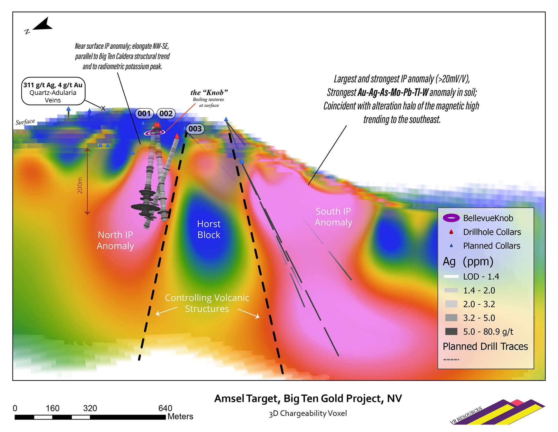
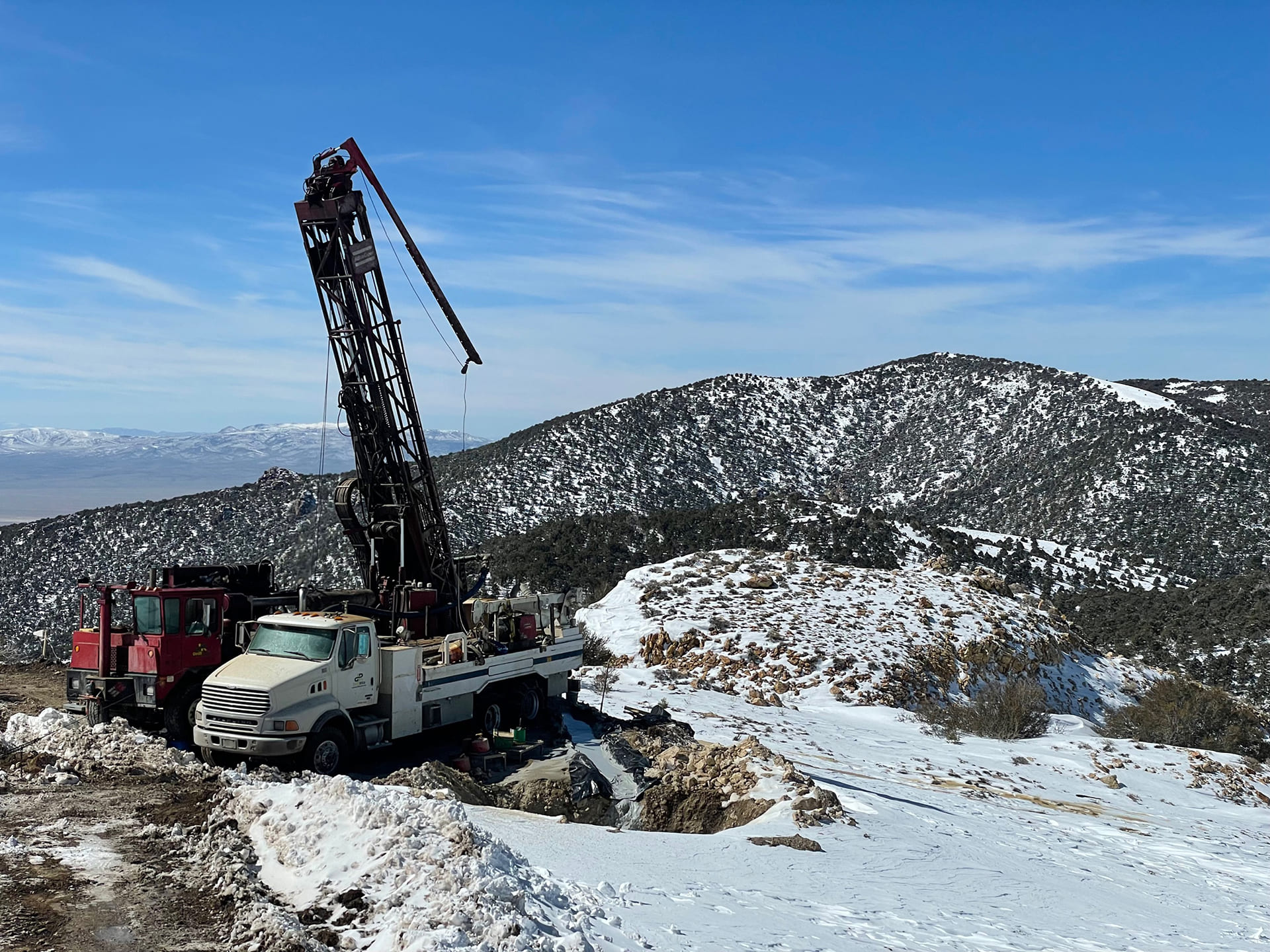
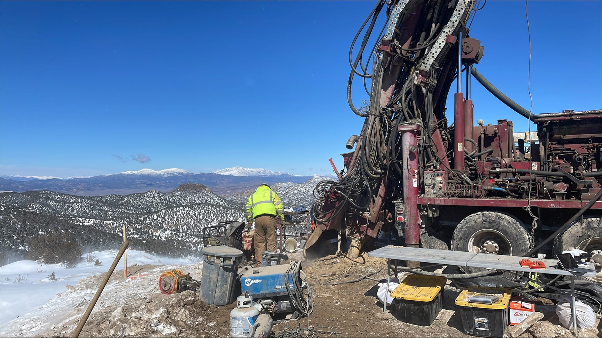
The goal of a two-stage, reconnaissance drill program planned for Amsel is to test separately the North and South IP anomalies respectively within the broad surface alteration footprint covering the hilltop. VR completed the first leg of the two-stage drill program in March, 2022.
- Three RC holes on North IP anomaly to depths ranging from 774 - 823 ft for each hole, for a total of 2,402 ft (732m).
- Each hole successfully intersected silica-sulphide alteration through its entirety.
- Water pressure at the 800 ft level resulted in the termination of each RC hole. Each hole bottomed in the silica-sulfide alteration in the core of the IP anomaly.
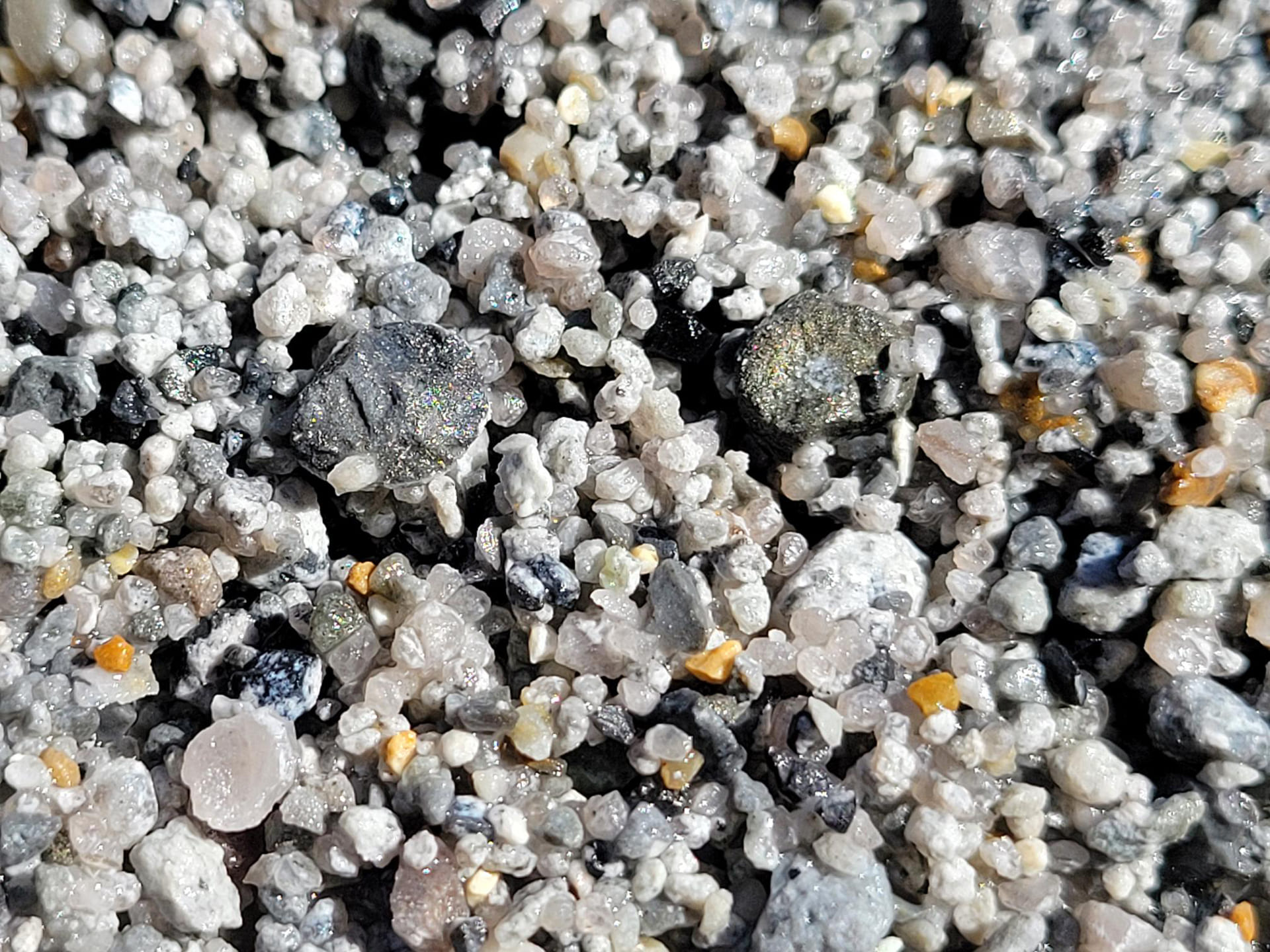
The three holes completed in the first leg of the program test along the strike of, and across, the northwest-trending axis of the North IP anomaly and corresponding airborne radiometric potassium anomaly which correlates with quartz-adularia alteration mapped on surface in rhyolite tuff and tuffisite breccia. Drill chips are mostly quartz-adularia altered tuff, hydrothermal quartz with sulfide, individual sulfide grains and sulfide clots, and tuffisite breccia with silica flooding and disseminated sulfide.
Gold and silver mineralization was intersected in altered tuff in the upper parts of Holes 1 and 2, and throughout the lower 205 ft of Hole 1, collectively spanning about 200 vertical metres overall in the uppermost part of the epithermal gold-silver system at Amsel:
-
Hole 1:
62.5m @ 15.9 g/t Ag & 0.10 g/t Au, incl.:
12.2m @ 32.6 g/t Ag & 0.12 g/t Au, starting at 211.8 m. - Hole 2: 7.6m @ 7.5 g/t Ag & 0.5 g/t Au starting at 7.6 m, incl. 0.9 g/t Au over 1.53 m.
Plans Going Forward
The South IP anomaly will be the focus for the second leg of the reconnaissance drill program. In comparison to the North IP anomaly drilled in the first leg, the South IP anomaly is:
- larger in plan view;
- more deeply rooted in cross-section;
- stronger in chargeability values, and;
- located below the strongest silver soil geochemistry with an associated high-temperature signature of thallium-tungsten-moly and lead. These data indicate that the southern block of the horst was the principal pathway hydrothermal fluids and pyrite deposition proximal to the high temperature source at Amsel.
As such, the goal of the second leg of drilling is to find higher concentrations of gold and silver in the southern horst block compared to those in the broad intersection in Hole 001 located in the adjacent structural block to the north.
The Big Ten caldera is a Tertiary-aged volcanic complex some 20 kilometres in diameter and located near the eastern limit of Tertiary-aged extension, volcanism, plutonism and faulting which define the Walker Lane Belt in west-central Nevada. The Round Mountain (20 M oz) and Manhattan (800,000 oz) epithermal gold deposits occur in similarly aged rhyolite caldera centers immediately to the northwest of Big Ten. The low-sulfidation character of the hydrothermal gold-silver quartz veins at Big Ten is also similar to Round Mountain.
The various properties occur along/within a northwest-southeast trending structural corridor which transects the entire Big Ten caldera. The trend of occurrences of epithermal gold-bearing quartz veins is referred to as the Big Ten mineral trend.
There is a consistent volcanic stratigraphy of welded and non-welded rhyolite tuff common to the mineral properties along the Big Ten trend. Certain tuff units are prospective for quartz vein deposition based on relative permeability. Aphanitic and porphyritic rhyolite and trachyite dykes and plugs are mapped at the Amsel and Hat Peak properties. Some dykes are coeval with epithermal alteration and mineralization, and some dykes post-date the epithermal fluid event.
There are common elements to the various occurrences of alteration and mineralization along the Big Ten trend. These attributes collectively strengthen the exploration model for the Big Ten mineral trend, and enable VR to explore and evaluate a complete epithermal gold system, both laterally and vertically. Salient features of the trend include:
- The three central properties all occur near regional-scale discordances, that is, offsets in the northwest-southeast trending Big ten structural corridor;
- Individual quartz veins on all three properties are subvertical and northwesterly striking, parallel to the Big Ten trend itself;
- The style of mineralization is that of a low-sulfidation epithermal system, but gold and silver values are commonly highest in samples with visible sulfide (pyrite): 1-5%; fine grained; disseminated to blebby; bright coloured and commonly euhedral;
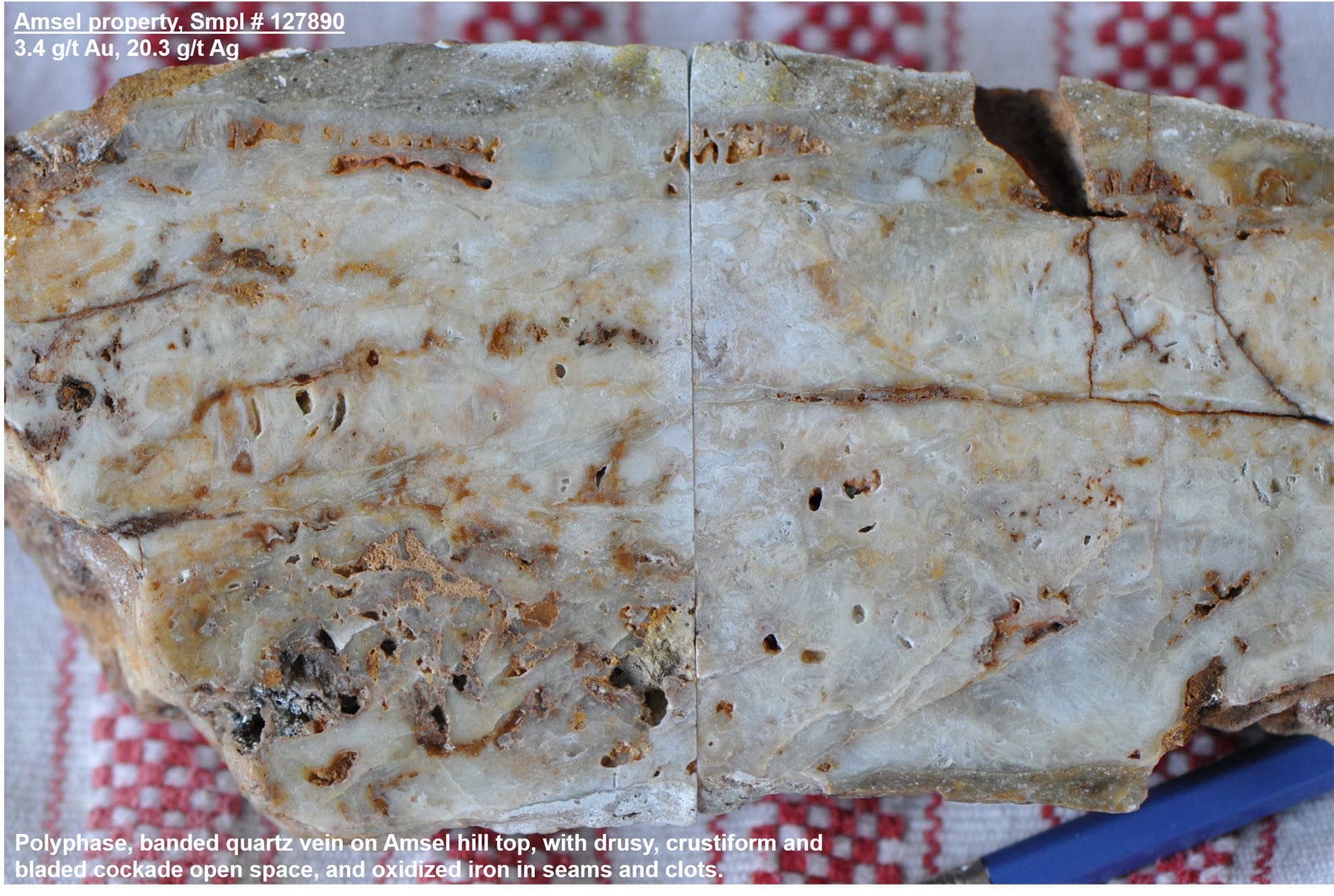
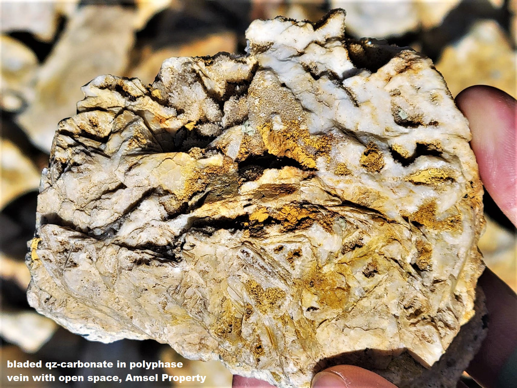
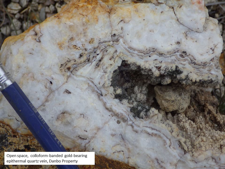
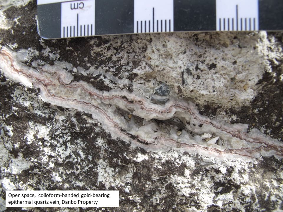
- Evidence for multiple phases of hydrothermal fluid pulsing is common and includes quartz veins with open space vugs lined by drusy quartz, banded quartz-adularia veins with colloform texture, and quartz-sulfide linings on vein breccia fragments or lithic tuff fragments in vein breccia and/or tuffisite with a pervasive quartz-adularia alteration of groundmass and fragments, and sericite overprint;
- Quartz veins do not occur in isolation, but in quartz vein sets across several hundred metres, with greater than one kilometre of strike length at Danbo and Clipper;
- Quartz vein sets are commonly associated with obvious zones of silicification, including a broad topographic hill of quartz-adularia-sericite alteration in bleached rhyolite tuff at Amsel, and distinctive, resistant ribs silicified rhyolite northwest of Amsel and at Clipper.
Geologic Age, and Correlation to Round Mountain gold-silver deposit
VR collected two samples from Amsel for age-dating:
- crystal-lithic tuff with pervasive quartz-adularia-sericite alteration overprint, and;
- unaltered quartz-biotite-feldspar porphyry dyke. The dyke crosscuts the altered tuff unit.
Age determinations from the University of Oregon using total fusion argon-argon systematics on orthoclase and adularia mineral separates are 25.57 and 25.10 Ma, respectively. The data support an evolving magmatic-hydrothermal system at Amsel where-by late-stage dykes intrude and crosscut earlier pyroclastic tuff units, marking the cessation of mineralization.
A mega-breccia unit from the western margin of the The Big Ten caldera, immediately west of Amsel, is dated at 25.73 Ma (Henry and John, GSA, 2013). It is closely followed by the 25.57 Ma date obtained by VR for the highly altered and mineralized nearby Danbo Tuff pyroclastic unit on the Amsel property itself. These age dates span the same geologic time as the age dates obtained for the Manhattan and Round Mtn. calderas located to the north (two papers published by Henry and John, and Best et. al, GSA, 2013).
The Round Mountain gold deposit surpassed 20 million ounces of production in 2020 (Kinross Mining Corporation). Artisanal mining began in 1906. Large-scale mining by modern pit and heap leach methods commenced in 1977 and continues to this day. The target at Amsel is a quartz vein stockwork system comparable to Round Mountain, based on numerous attributes:
- Age. Occurrence in adjacent Tertiary volcanic calderas between 25-27 million years old;
- Setting. Location of the epithermal quartz vein stockwork system at or near the margin of the caldera, in proximity to contact with basement;
- System. Gold and silver mineralization in a low-sulfidation, epithermal quartz vein system;
- Trap. Mineralization hosted in unwelded tuff below a cap unit of welded tuff
- Adularia. Large-scale potassium alteration footprint of quartz-adularia, with a specific correlation of gold-silver mineralization to increasing adularia in the core of the system;
- Pyrite. Correlation of gold-silver mineralization to pyrite at Amsel, and along entire Big Ten trend of showings.
Danbo is an epithermal gold prospect hosted in a sub-horizontal Tertiary pyroclastic sequence of rhyolite lapilli tuff and ash flow tuff. The volcanic stratigraphy exposed on the Danbo property consists of 4 well-defined felsic pyroclastic units. The pyroclastic units are sub-horizontal and do not show evidence of major faulting. No vertical or horizontal translations are evident across the major veins transecting the property.
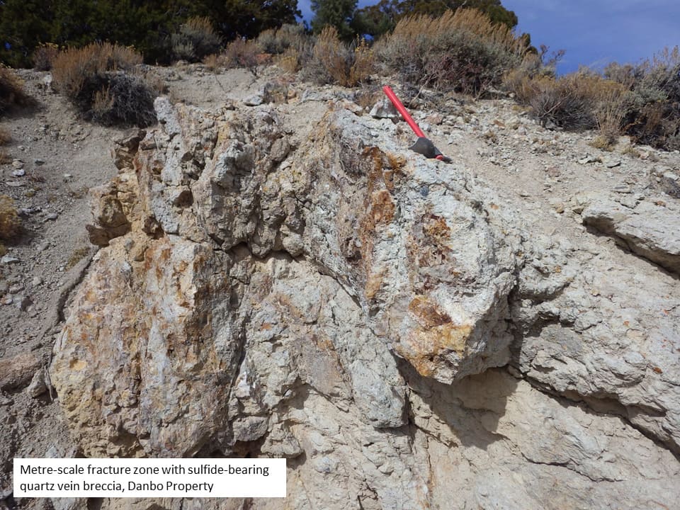
A series of northwest-striking epithermal quartz veins can be traced across a north-trending valley incised into the pyroclastic sequence for approximately 1,500 m of strike. Three or four distinct zones of veined tuff are mapped across an overall width of 300 to 400 metres, with an additional zone inferred from soil geochemistry and hyperspectral surface alteration data implying a width of 1.1 km. Individual veins are centimetres to decimetres wide, with metre-scale zones of quartz vein breccia in the central part of the property. Narrow (less than one meter), white weathering, crystalline mica-bearing argillic alteration halos are evident at most vein outcrops.
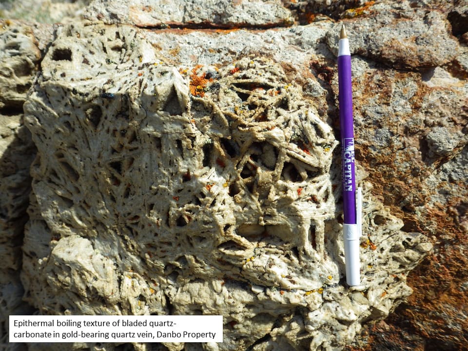
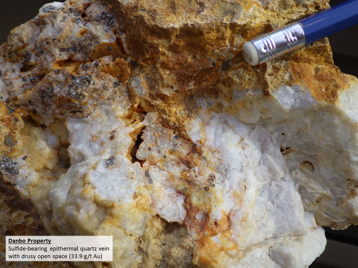
Drusy quartz in open space is nearly ubiquitous along the 1,500 m strike length. Bladed quartz after carbonate is also common, evidence of hydrothermal boiling in the high-level, low-sulfidation epithermal vein system at Danbo. Banded, colloform textures, vuggy open space with drusy quartz, and vein breccia with quartz-lined fragments are observed in the topographically lowest, central part of the property (see hand sample photos on this website Project Page).
The quartz veins generally contain trace to 1%, fine grained sulfide minerals as disseminated grains and blebs, most commonly a bright coloured euhedral to subhedral pyrite. Base metals are not present in Big Ten quartz veins. Gold-silver ratios in mineralized samples with visible sulfide are typically 10:1 or less. At Amsel, gold-silver quartz veins in historic surface workings are within a large-footprint silica-adularia-sericite high resistivity alteration cap which is anomalous in gold and silver, the epithermal trace element indicators arsenic and antimony, and the high temperature elements bismuth, tungsten, lead and molybdenum.
