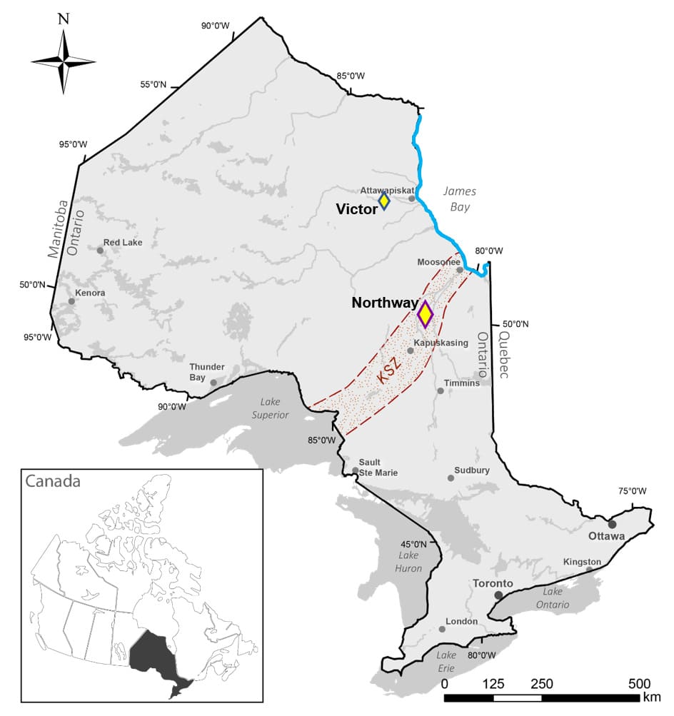
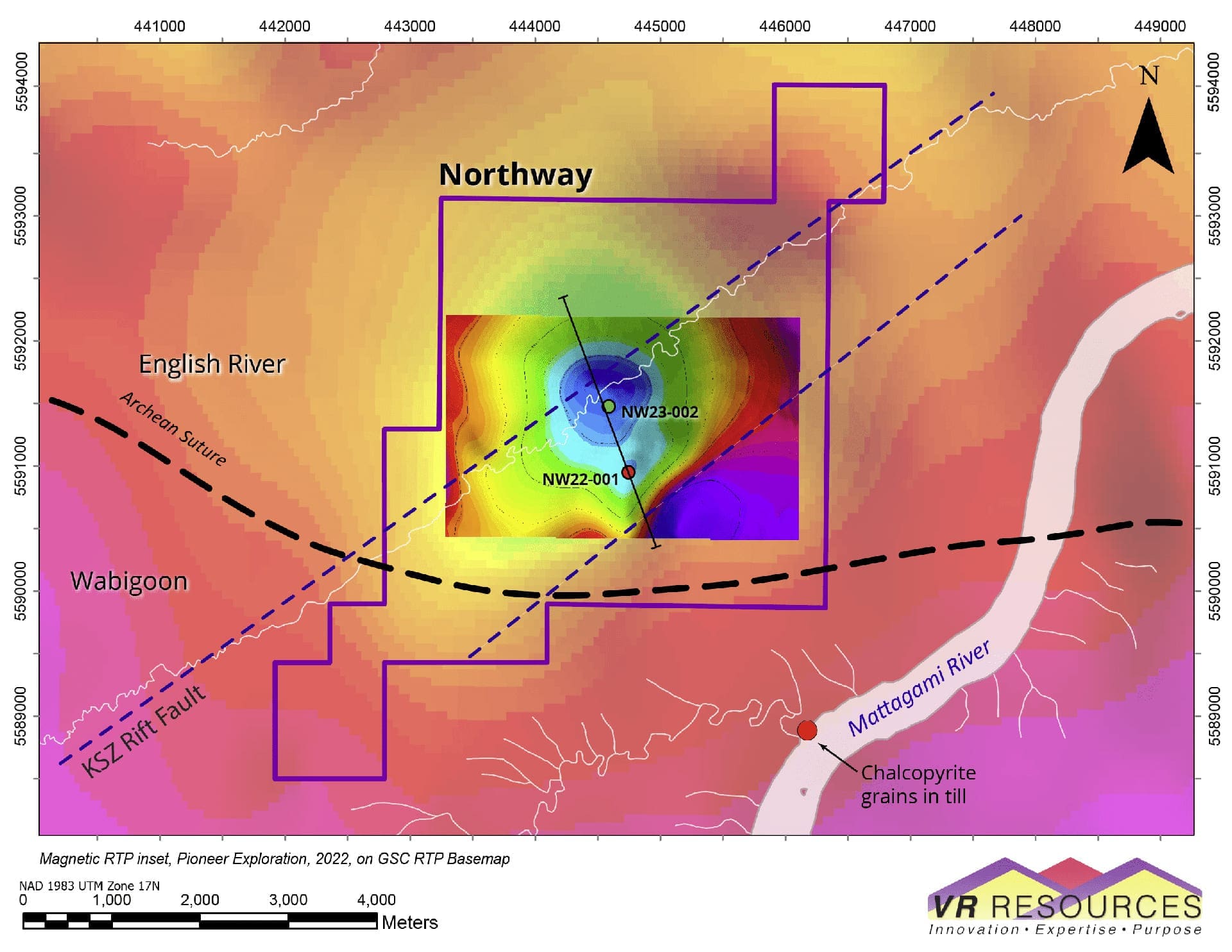
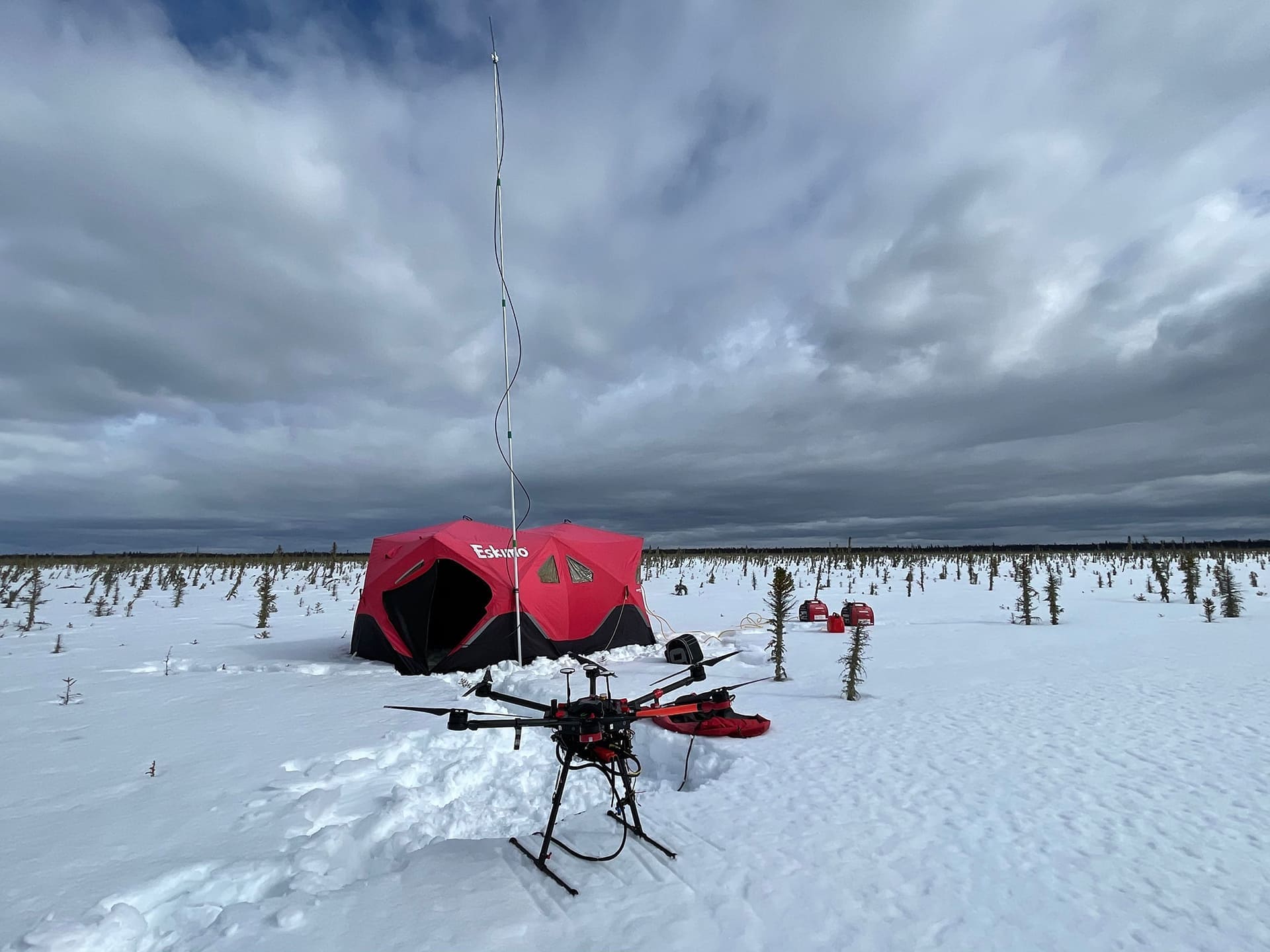
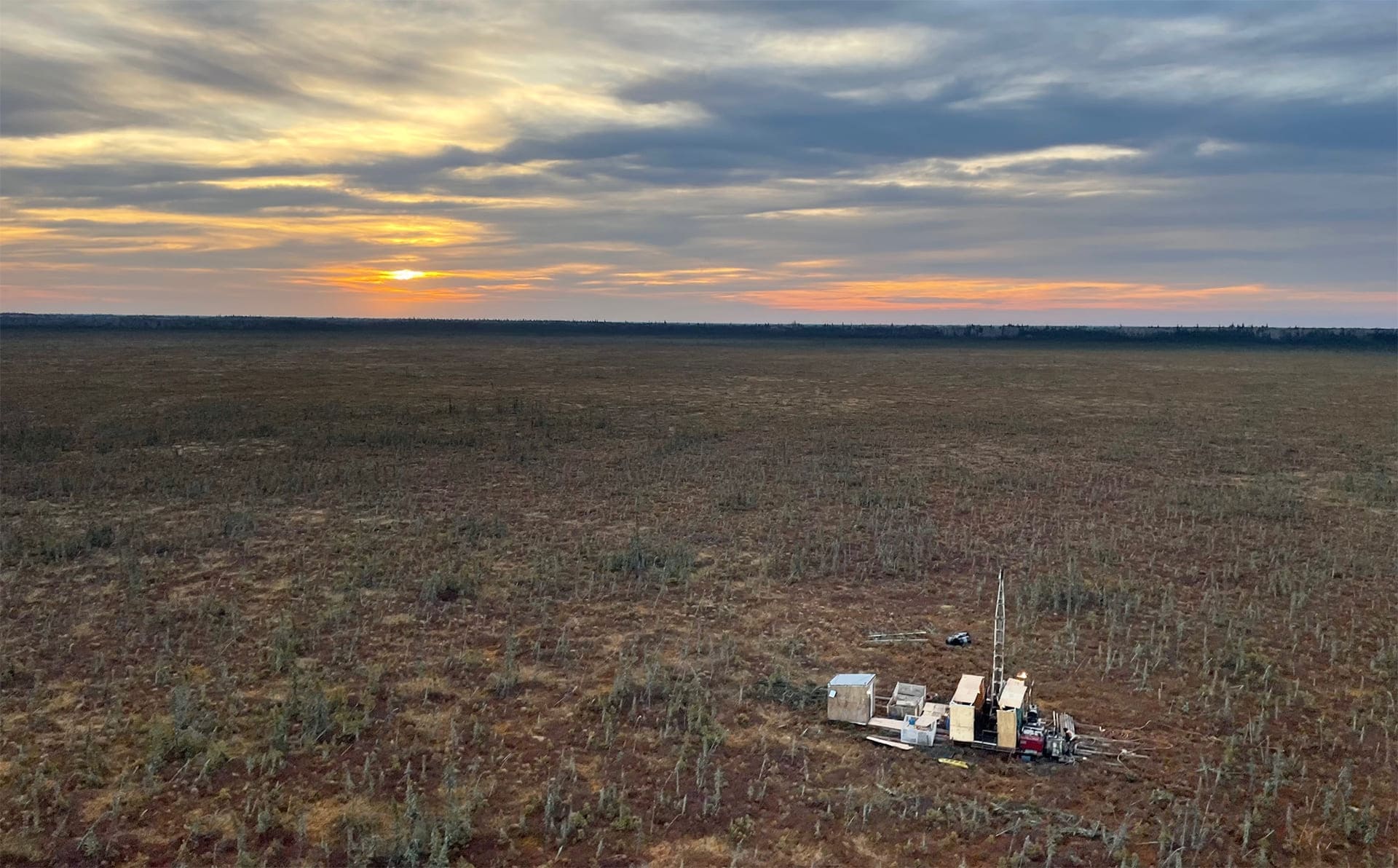
Prior to putting the first drill hole ever into Northway
in November 2022, the Company completed a low-cost, ultra – high
resolution drone magnetic survey over the core of the property in March.
The survey was designed to map and delineate structures within the large
magnetic low observed in regional government surveys. The final survey
covers a 2 x 3 km block, comprising 108 line at 50 m spacing and 8 tie
lines for a total of 120 line-km. The survey produces a very high
resolution of data because of the tight line spacing, the low “tree-top”
flight altitude of the drone at just 30 metres above ground, and a
computerized flight control paired with a new, very high sensitivity
potassium-vapour magnetometer.
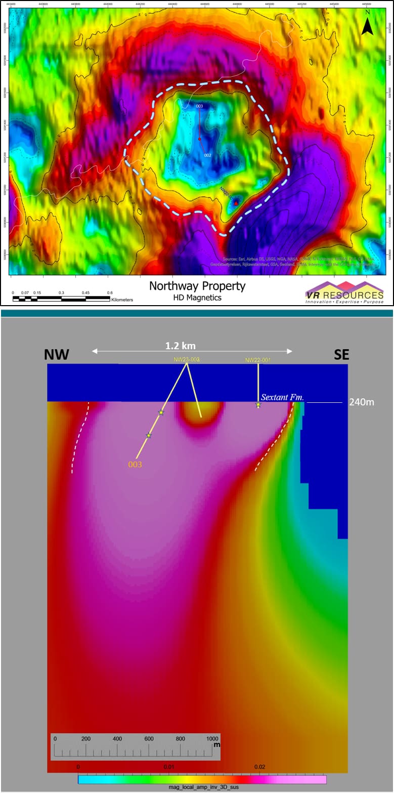
In addition to the standard, processed deliverables from
the survey, VR contracted an independent 3D MVI inversion model based on
magnetic amplitude data derived from the original drone survey in order
to refine the external boundaries and internal geometries of the anomaly
in three dimensional space. As illustrated on the
resultant RTP plan map and 3D MVI section shown on this Project Page
, the external boundary conditions for the magnetic anomaly at Northway
are consistent from 900 – 1,200 m across, sub-vertical in nature, and
open to depth beyond the 1,000 metre vertical extent of the 3D inversion
model.
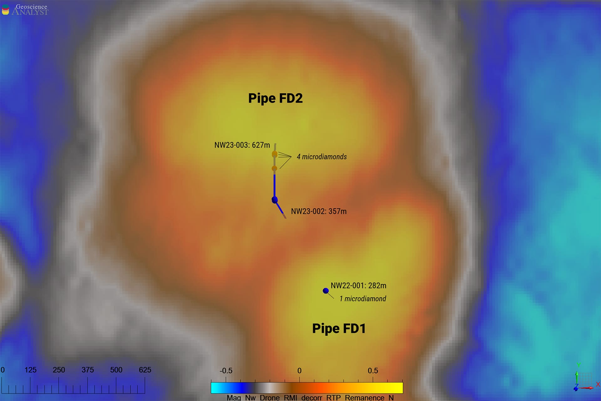
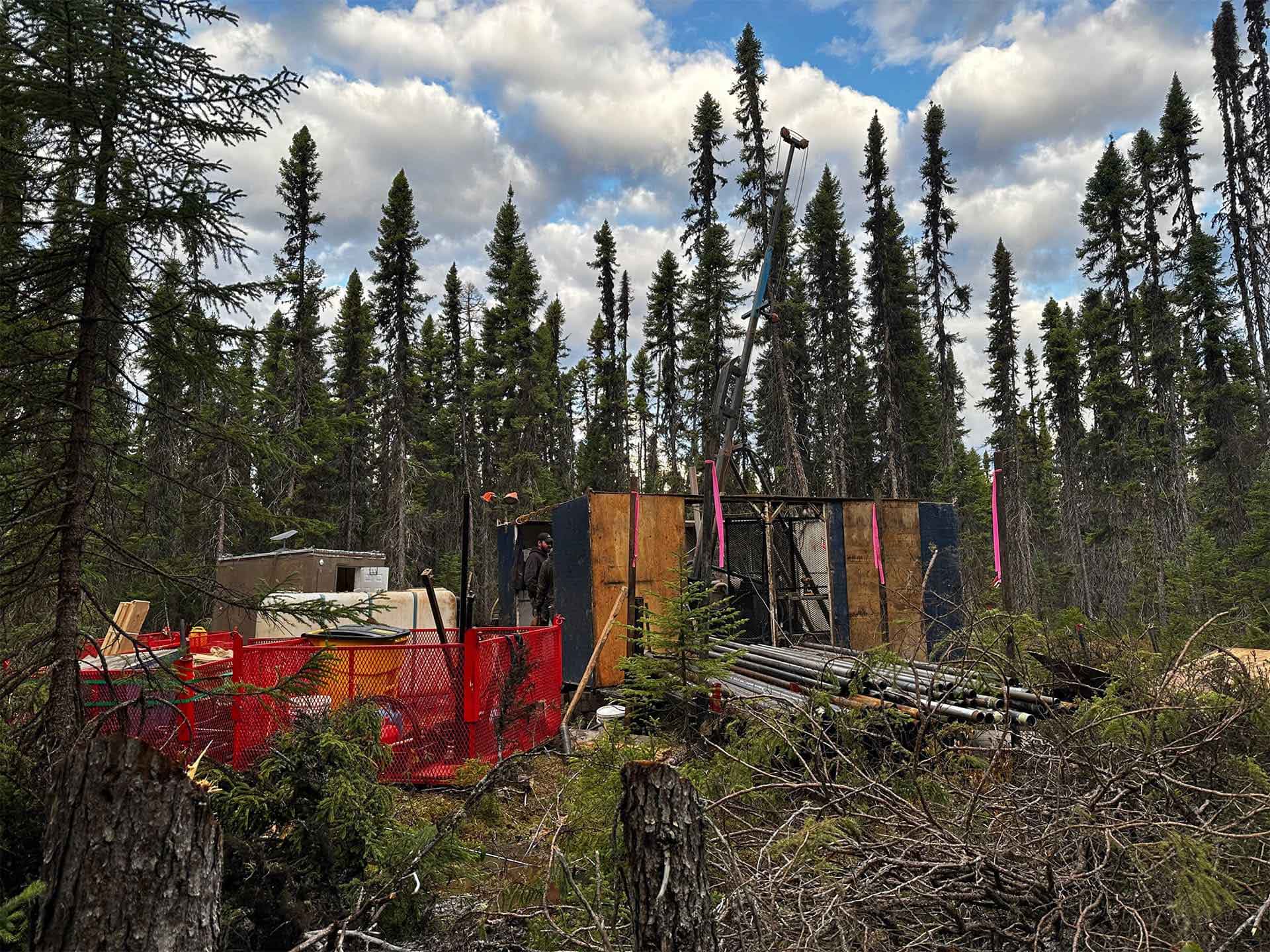
Drill Hole NW022-001 was completed to 282m in November,
2022, on the southeastern margin of the circular magnetic feature. It
intersected a kimberlite diatreme breccia pipe preserved below Paleozoic
limestone and sandstone cover, starting at a depth of approximately 240
m. Follow-up drill hole NW23-002 was completed to 357 m depth in May,
2023. Located in the center of the anomaly, it is a 450 metre step-out
from Hole 001, and it intersected kimberlite at exactly the same depth
as in Hole 001, preserved below the cover of Devonian limestone and
sandstone.
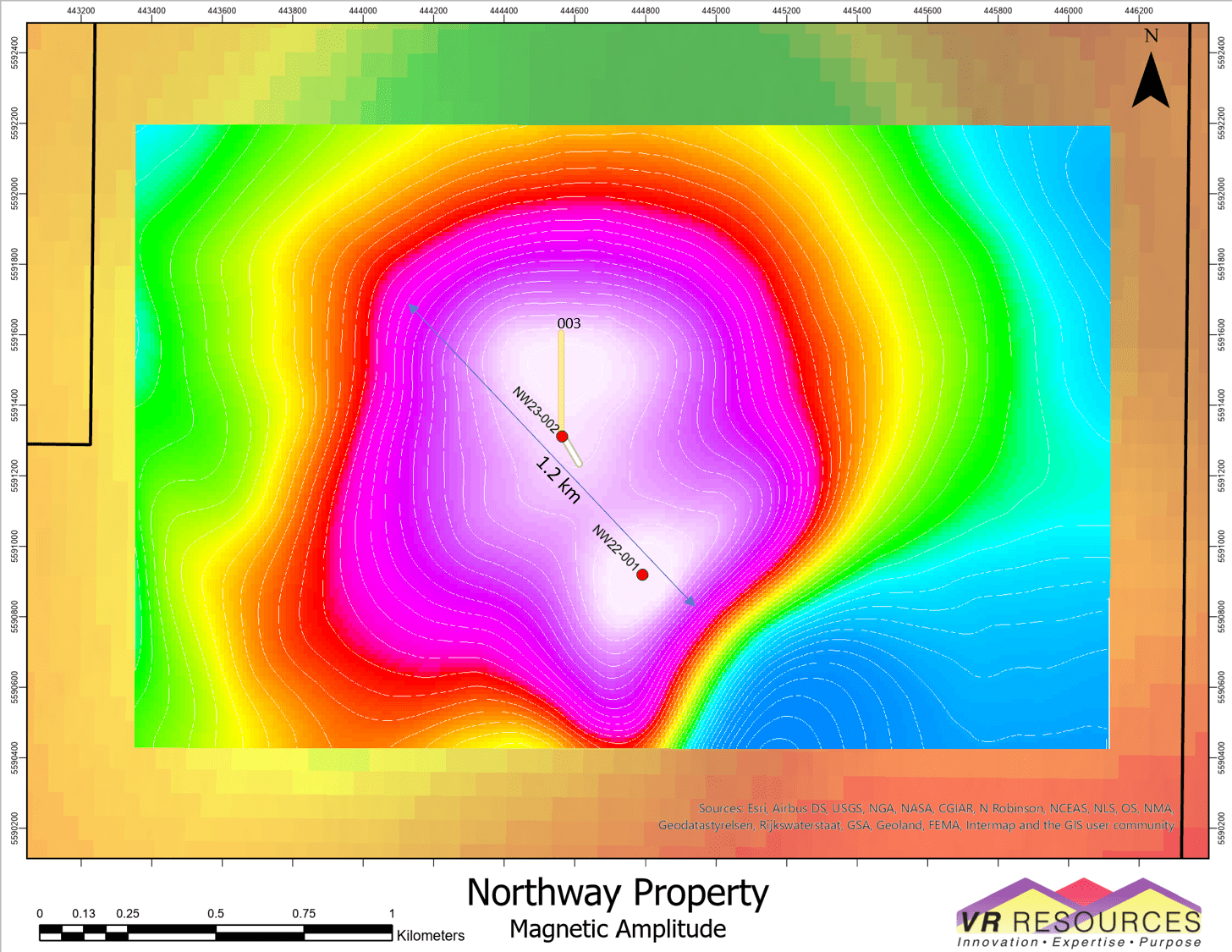
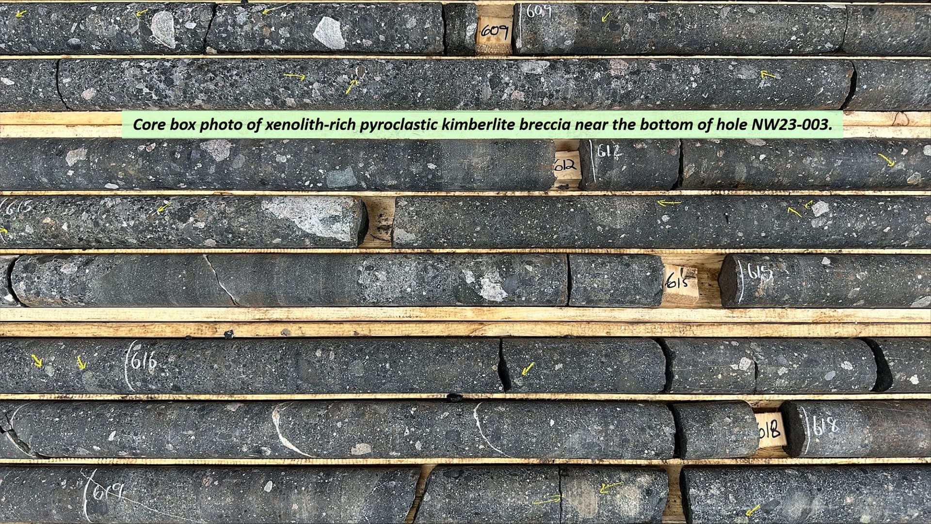
Drill hole 003 was completed to 627 m depth in July,
2023, from the same collar location as hole 002, but inclined at -65o to
the north, to intersect the heart of the magnetic anomaly at Northway,
that is, the center of the highest magnetic amplitude data, and directly
above the roots of the magnetic anomaly evident on the 3D inversion
model. The hole ended in xenolith-rich kimberlite breccia (XPK), open to
depth.
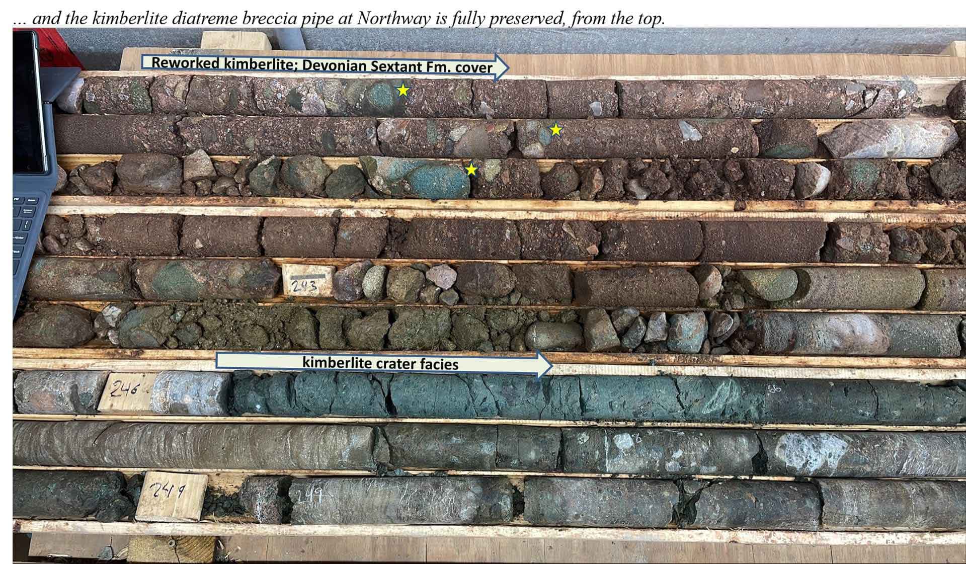
All three drill holes at Northway intersected various
kimberlite breccia phases below a cover of Paleozoic limestone and
sandstone, as shown in the
schematic cross section on this Project Page
. Both holes 001 and 002 were terminated because of caving in the
sandstone, but the drill-stem integrity was maintained in hole 003 for a
more complete intersection into the kimberlite breccia complex below the
sandstone cover.
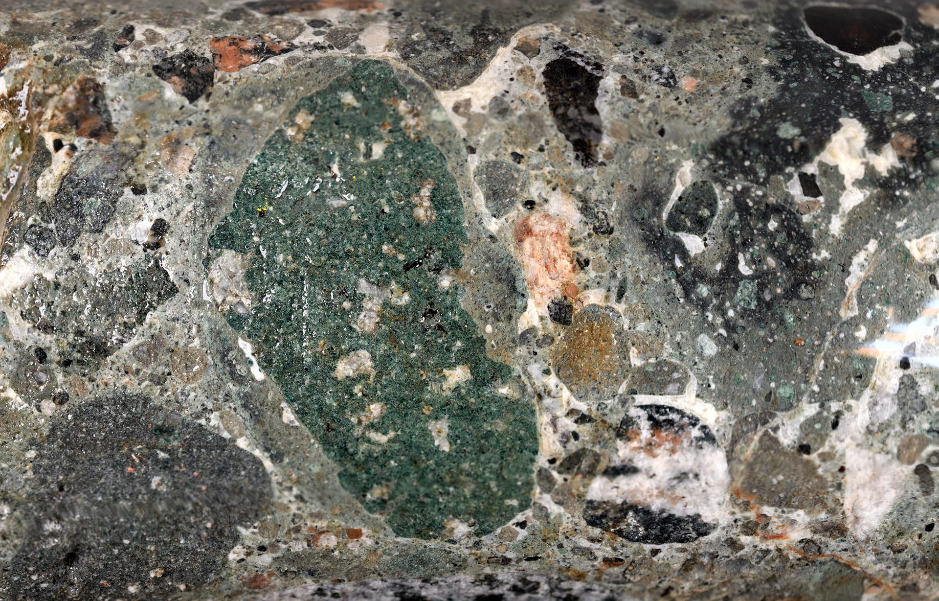
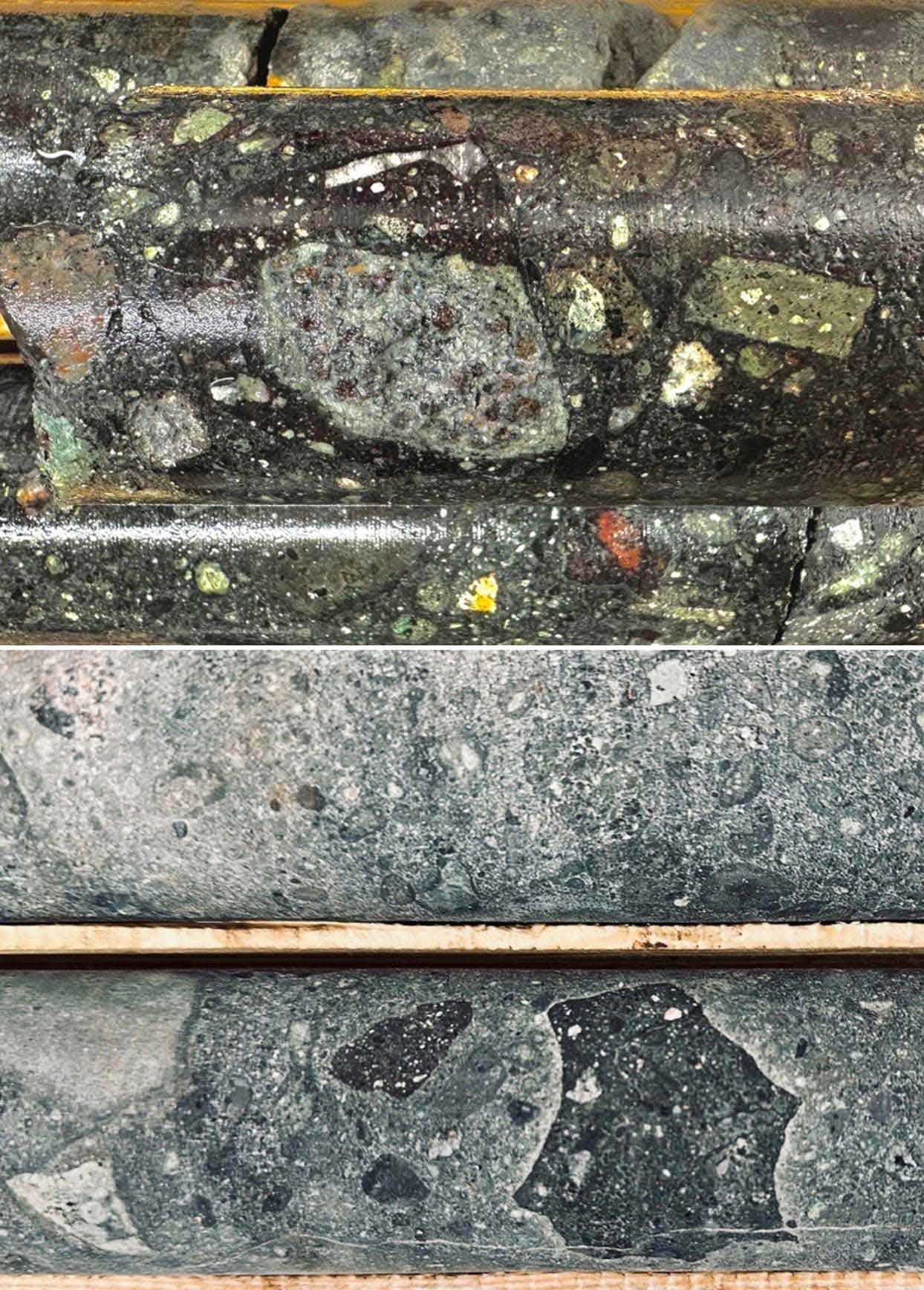
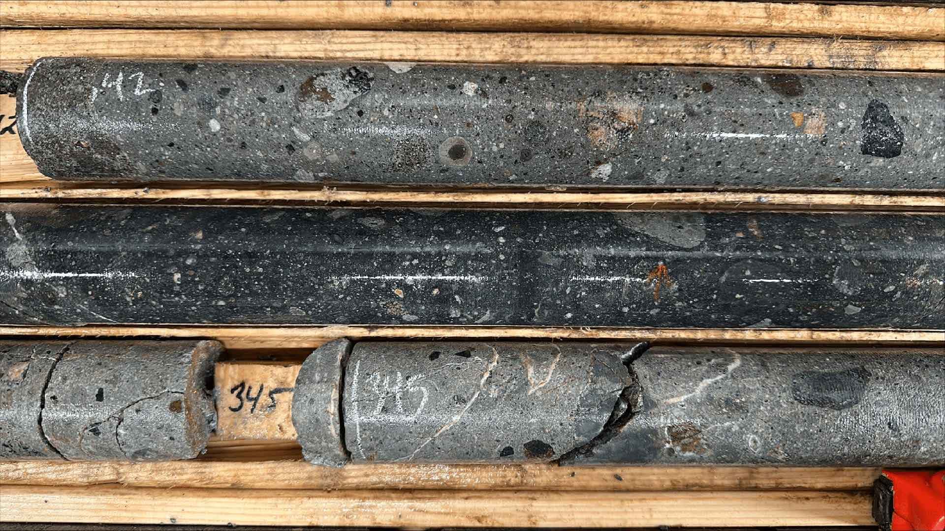
Kimberlite breccia from drill holes 1, 2 and 3 spans
approximately 700 metres laterally across the kimberlite breccia
pipe complex, and approximately 320 metres vertically below the
sandstone cover.
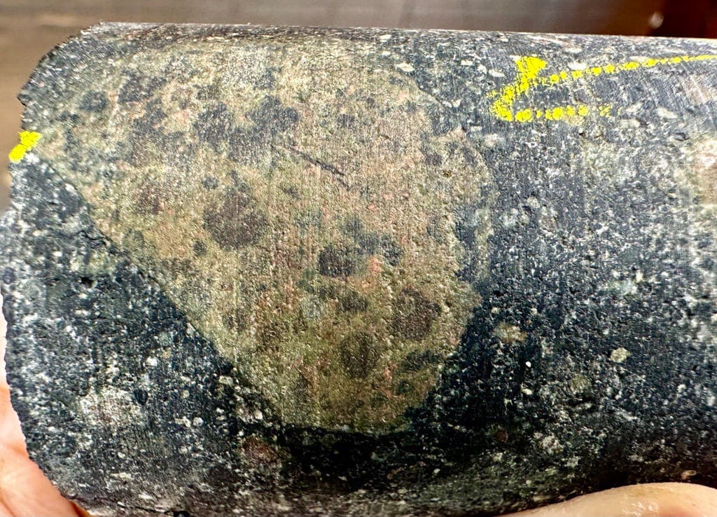
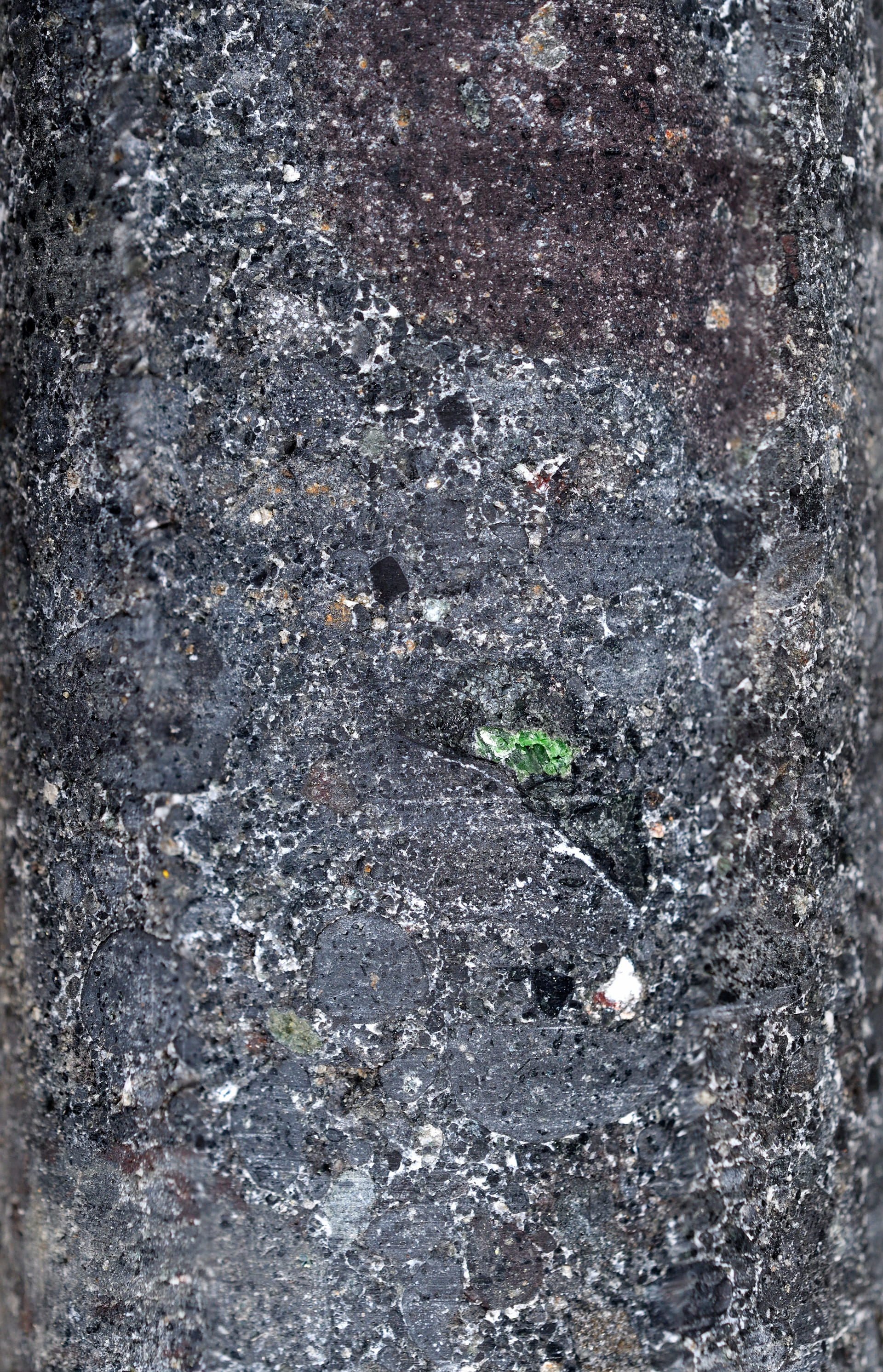
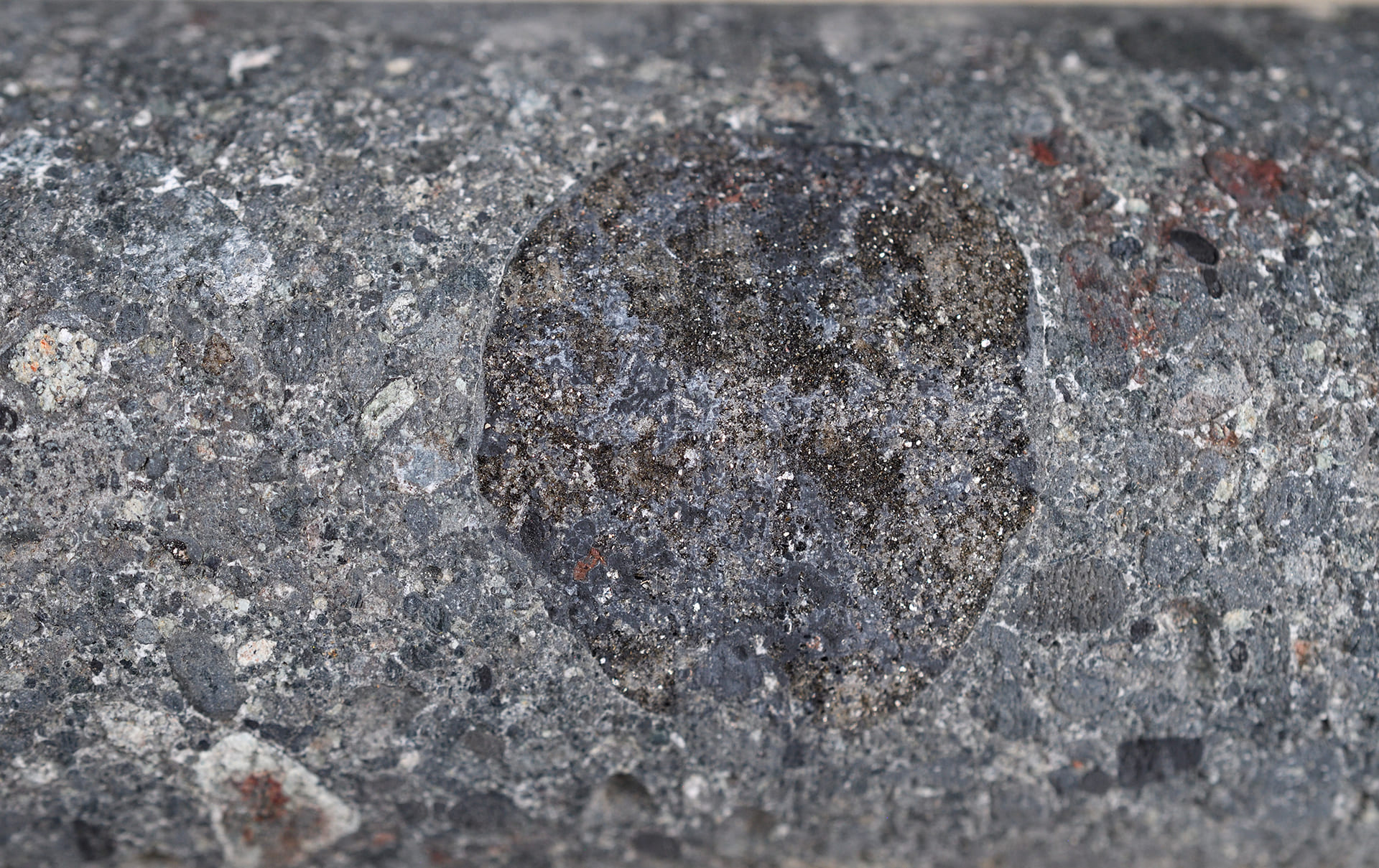
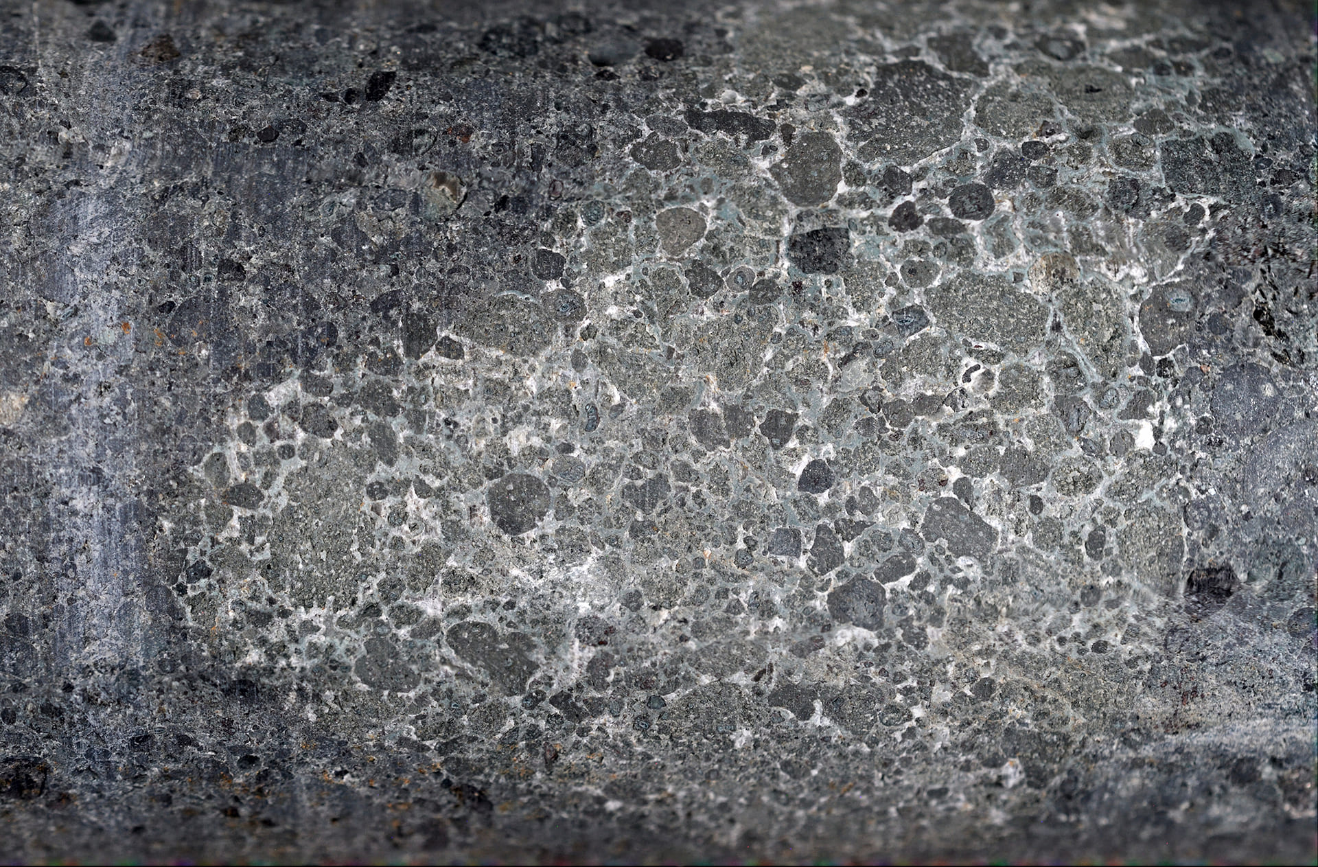
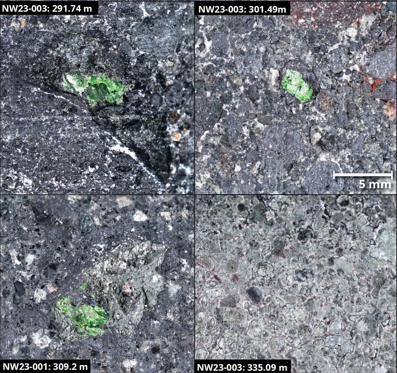
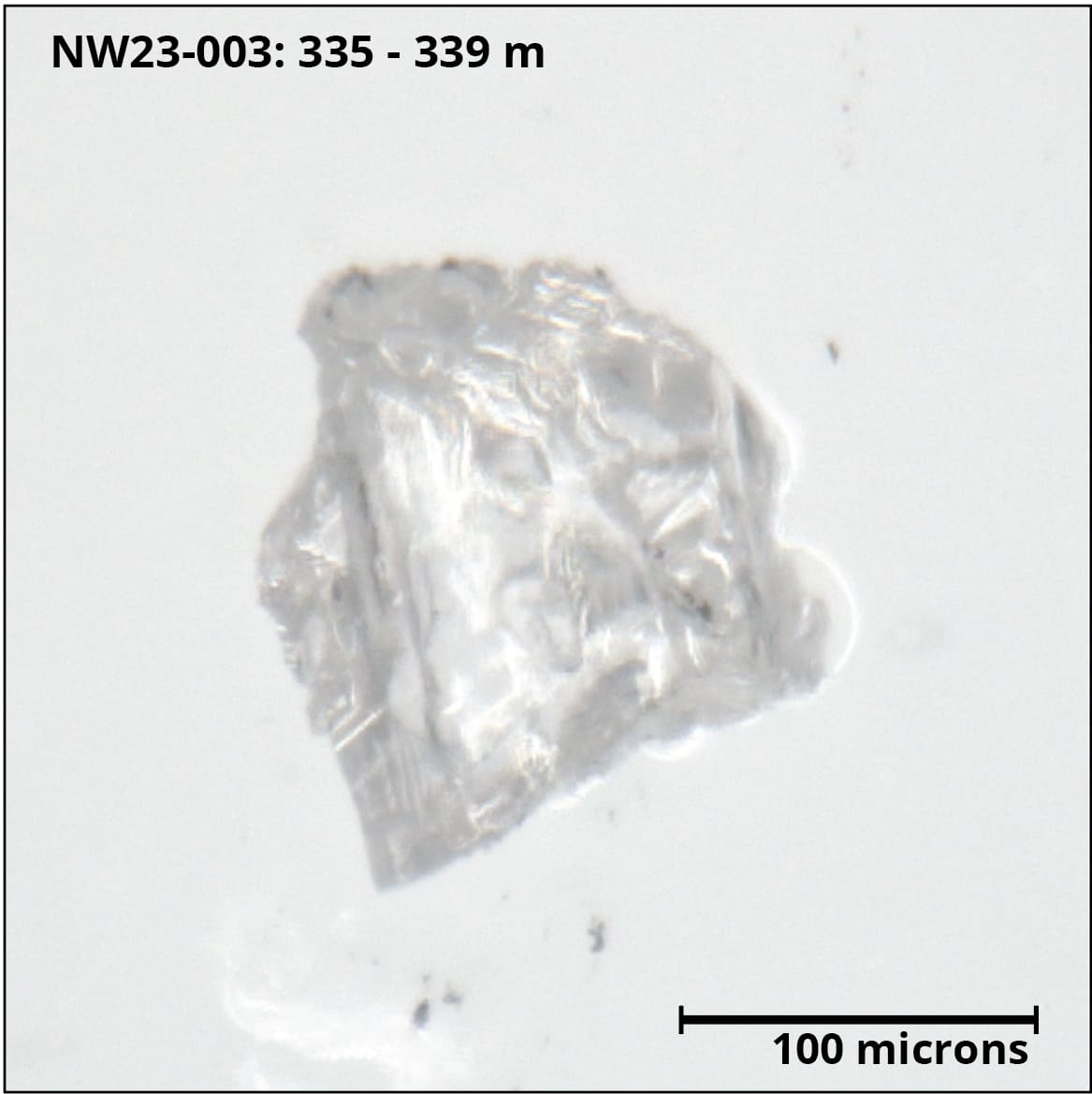
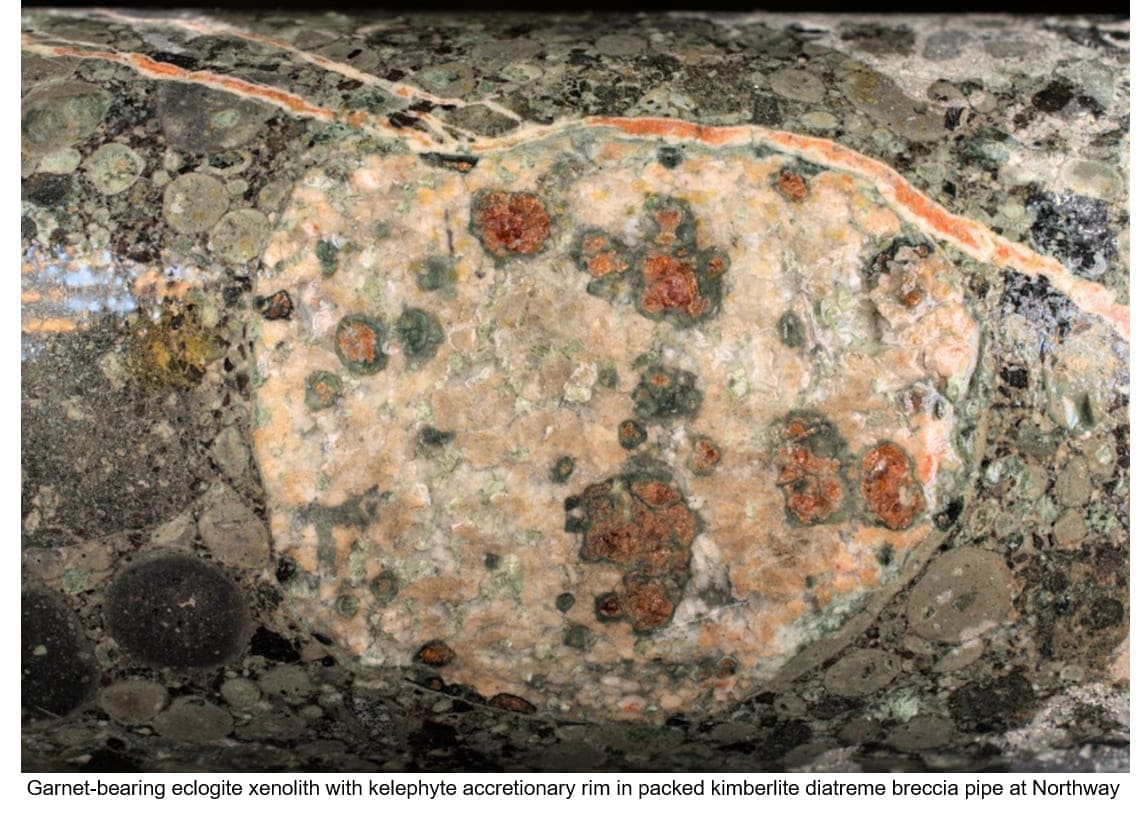
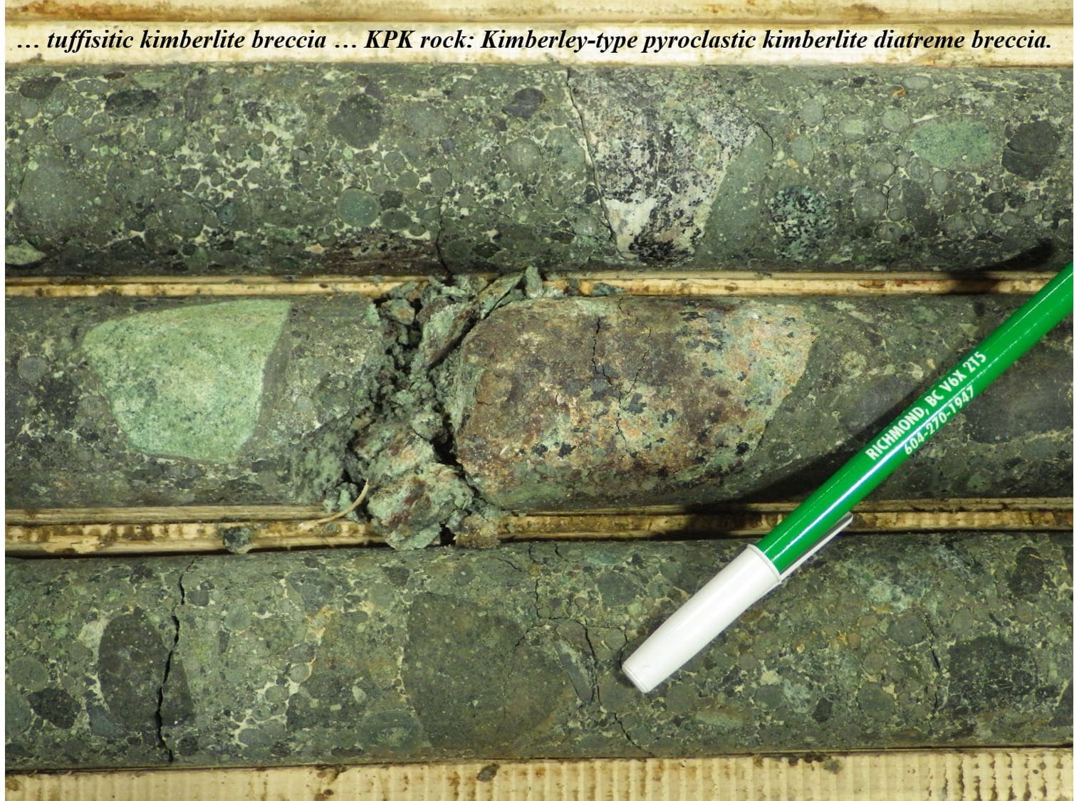
Drill core photos included on this website provide a
snapshot of the array of textures and important mineralogy observed
to-date, including xenolith-rich Kimberley-type pyroclastic kimberlite
breccia textures (“KPK” or “XPK”), accretionary magmaclast-rich KPK, and
more crystalline, hypabyssal or coherent kimberlite (“CK”) phases.
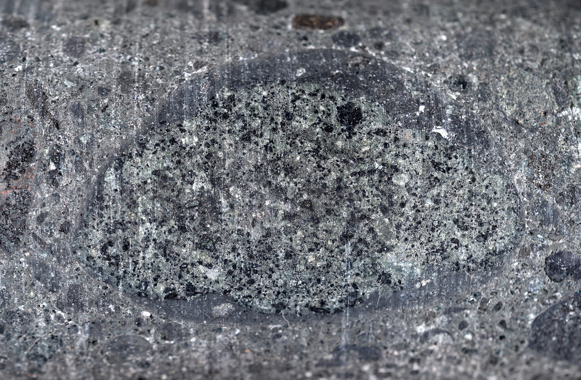
Overall, lower crust and mantle - derived eclogite and websterite
xenoliths are observed in KPK rock in all three drill holes, together
with phlogopite and olivine megacrysts and spherulitic magmaclasts
commonly cored by olivine which increase in abundance downwards in both
holes 002 and 003. Kelyphite rimmed garnet-bearing eclogite xenoliths
occur at 330.8 m near the bottom of hole 002, and in websterite
xenoliths with accretionary rims in the lower part of hole 003. Fine
grained ilmenite is observed in KPK in hole 001.
Crater facies kimberlitic mudstone and reworked
volcaniclastic kimberlite (“RVK”) which formed at the very top of
kimberlite breccia complex at Northway are preserved immediately below
the cover of Devonian sandstone in Hole 001, and potentially in Hole
003, in association with KPK rock with an abundance of crystalline
wallrock/country rock fragments.
Compositional Data.
VR has initiated a range of petrology, whole-rock
geochemistry and mineral chemistry studies of drill core samples from
from drill holes 001 and 003.
For drill hole NW22-001, compositional data were obtained
from 2 samples of drill core submitted for wholerock and ICP-MS trace
element geochemistry at ALS Laboratories, and from analysis of 15
samples of pelletal, accretionary diatreme breccia by an electron
microprobe (EMPA) equipped with an Energy Dispersive Spectrometer (EDS)
by Renaud Geological Consulting Ltd. (RGC) based in London, Ontario,
with extensive experience in kimberlite exploration, geology and
mineralogy. Initial studies and data from Hole 001 include:
-
Deep crustal glimmerite xenoliths composed of massive phlogopite are
common;
-
Phlogopite xenocrysts and mineral grains in xenoliths plot within
kimberlite fields on Ti-Al plots, and in kimberlite-orangeite field
on Al-Fe plots;
-
Melilite is observed in phlogopite-dominated magmaclasts and in
accretionary rims;
-
Garnet is observed within altered xenocrysts of eclogite or
websterite;
-
Accretionary lapilli are mainly biotite-phlogopite (now illite),
surrounded by illite, dolomite-ankerite, F-apatite, and perovskite;
-
Pelletal lapilli are hosted in a groundmass of carbonate,
Ti-Ba-biotite-phlogopite including glimmerite nodules, F-apatite,
Al-spinel, clinopyroxene, Nb-ilmenite, monazite and perovskite.
Two analyses from a Mg-rich chromite heavy mineral grain
recovered from the diamond-bearing kimberlitic mudstone at the top of
the breccia pipe intersection also plot within the diamond stability
field, consistent with the compositional data of the phlogopite
xenocrysts.
There are similar results for drill hole NW23-003; the
initial data and observations from two samples of pelletal, accretionary
diatreme breccia include:
-
Ti-K richterite, a mantle sourced amphibole, in a glimmerite
magmaclast nodule;
-
Fine grained diopside, a clinopyroxene, containing 0.15 wt%
chrome;
-
Deep crustal glimmerite xenoliths composed of massive
phlogopite are common;
-
Phlogopite xenocrysts and mineral grains in xenoliths plot within
kimberlite fields on Ti-Al plots, and in kimberlite-orangeite
field on Al-Fe plots;
-
Accretionary lapilli are mainly biotite-phlogopite (now illite),
surrounded by illite, dolomite-ankerite, F-apatite, and
perovskite, and;
-
Pelletal lapilli are hosted in a groundmass of carbonate,
Ti-Ba-biotite-phlogopite including glimmerite nodules,
F-apatite, Al-spinel, clinopyroxene, Nb-ilmenite, monazite and
perovskite.

.jpg)
.jpg)
.jpg)
.jpg)